+386 1 292 73 90info@geavis.si
SI
logo
Geavis
logo
  • Services
    • Spatial Data Acquisition
    • Advanced Spatial Data Processing
    • Geospatial Analysis
    • Visualizations and Presentations
  • Applications
    • Governmental Institutions and Public Sector
    • Real Estate
    • Mapping and Land Surveying
    • Civil Engineering
    • Industry and Infrastructure
    • Quarries and Open Mines
    • Agriculture and Forestry
    • Insurance
    • Spatial Research
    • Tourism and Promotion
  • Technology
  • Projects
  • Geavis
    • Geavis
    • Clients
    • Contact
  • Blog
The importance of georeferencing raster images
12.07.2016 Technology
The importance of georeferencing raster images

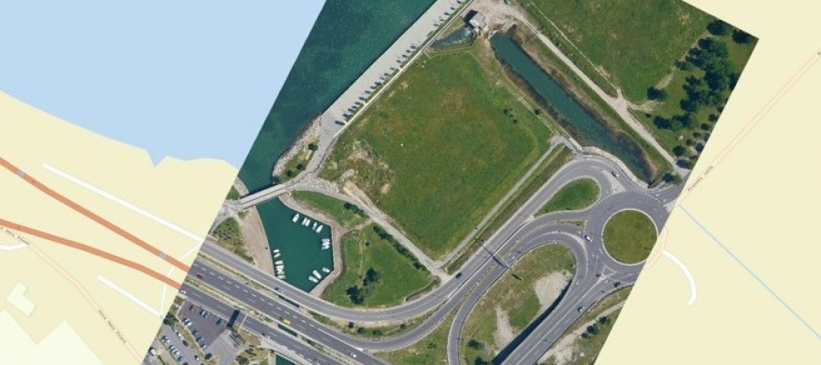
The images of the Earth’s surface taken with a satellite or an aircraft (satellite images, aerial photos etc.) are ordinary digital photos that lack the information on how ...

Continue
How various methods of data capture produce different point clouds
08.07.2016 Technology
How various methods of data capture produce different point clouds

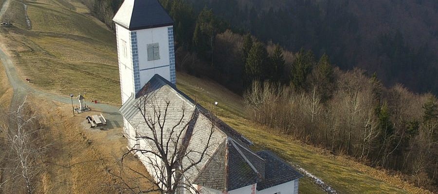
Different techniques of capturing spatial data make it possible to create point clouds with various characteristics. Geavis compared point clouds obtained by using two different technologies ...

Continue
How can a lightweight unmanned aircraft be stable enough to capture high resolution aerial photos?
11.05.2016 Technology
How can a lightweight unmanned aircraft be stable enough to capture high resolution aerial photos?

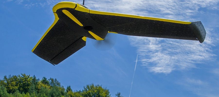
Every time senseFly unmanned aircraft captures a photo, it stops the operation of the engine and stabilized itself, and thus prevents vibrations that would distort the resulting aerial image ...

Continue
Geavis aerial photography in the annual report of Petrol
09.05.2016 Real Estate
Geavis aerial photography in the annual report of Petrol

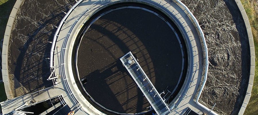
In creative design of the annual report for its client, the largest Slovenian energy company Petrol d.d., SM Studio Marketing planned a photographic material that would display a wide range ...

Continue
Civil Aviation Agency confirmed Geavis` Operations Manual
24.04.2016 Regulations
Civil Aviation Agency confirmed Geavis` Operations Manual

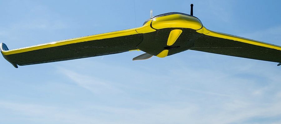
Geavis is the first and only Slovenian company so far, to which the Civil Aviation Agency of the Republic of Slovenia officially confirmed its Operations Manual for operations ...

Continue
What does GSD tell and how is it related to the spatial resolution aerial photographs?
20.02.2016 Technology
What does GSD tell and how is it related to the spatial resolution aerial photographs?

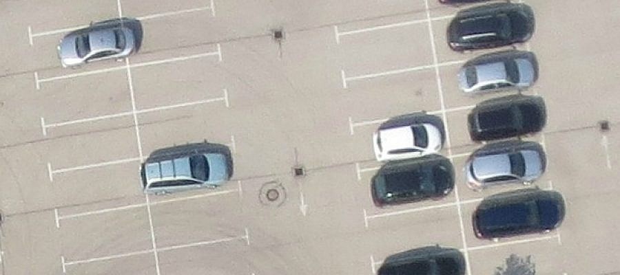
Digital aerial photos are composed of a matrix of pixels. Each pixel is actually a small square. GSD (Ground Sample Distance) tells the size of the side of this ...

Continue
Archaeological heritage from the air
15.02.2016 Spatial Research
Archaeological heritage from the air

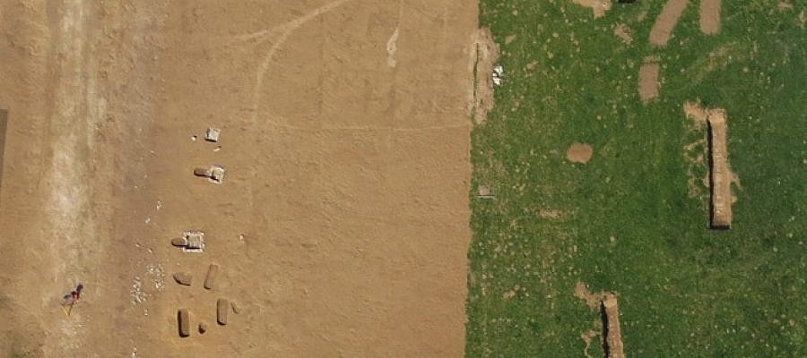
For scientific projects and research of archaeological heritage, a comprehensive overview of the landscape and its elements is essential. It is also useful to have a look from different ...

Continue
What UAV to choose? Fixed wing or rotary drone?
02.01.2016 Technology
What UAV to choose? Fixed wing or rotary drone?

While until not so long ago drones were mainly used in the domains of military industry and miniature enthusiasts, they have now become becoming part of our everyday life ...

Continue
Why are GCPs needed in photogrammetry?
10.12.2015 Technology
Why are GCPs needed in photogrammetry?

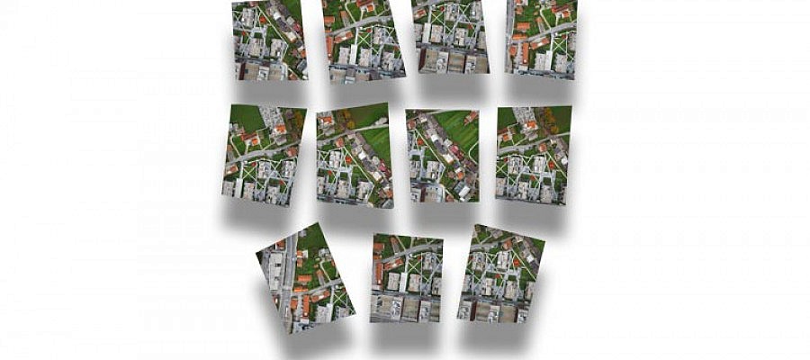
Ground Control Points (GCP) are points on the ground with known coordinates in the spatial coordinate system (i.e. both coordinates defining horizontal position and the altitude coordinate). Their coordinates are ...

Continue
Slovenia in the laser scanning data
05.11.2015 Technology
Slovenia in the laser scanning data

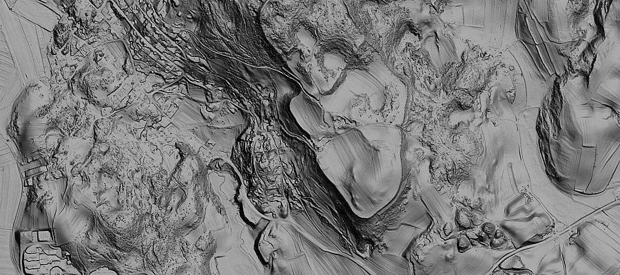
In September 2015, the Ministry of Environment and Spatial Planning began to provide terrain data for the whole of Slovenia. The data required for this purpose has been obtained ...

Continue
Depictions of earth’s surface and visualization of future
29.10.2015 Technology
Depictions of earth’s surface and visualization of future

Any construction of new facilities requires intense preparations, in particular when speaking about business premises, infrastructure or facilities of wider social importance. New buildings may cause adverse effects on the ...

Continue
How are true orthophoto mosaics made?
15.09.2015 Technology
How are true orthophoto mosaics made?

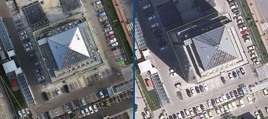
Nowadays, an orthophoto mosaic is one of the most popular products of modern photogrammetry. It is a product that explicitly shows ground terrain and constructed buildings. With the development of ...

Continue
Prev.Next
  • 1
  • 2
  • 3
  • 4
  • 5

Categories

  • Agriculture and Forestry (4)
  • Mapping and Surveying (2)
  • Public Sector (1)
  • Quarries and Open Mines (2)
  • Real Estate (3)
  • Regulations (5)
  • Spatial Research (2)
  • Technology (40)
  • Trends (13)

Archive

  • January 2019 (1)
  • September 2018 (2)
  • June 2018 (1)
  • March 2018 (1)
  • January 2018 (2)
  • December 2017 (1)
  • September 2017 (1)
  • June 2017 (1)
  • May 2017 (2)
  • April 2017 (1)
  • March 2017 (1)
  • February 2017 (1)
  • January 2017 (3)
  • December 2016 (1)
  • November 2016 (1)
  • October 2016 (1)
  • September 2016 (2)
  • August 2016 (1)
  • July 2016 (2)
  • May 2016 (2)
  • April 2016 (1)
  • February 2016 (2)
  • January 2016 (1)
  • December 2015 (1)
  • November 2015 (1)
  • October 2015 (1)
  • September 2015 (2)
  • August 2015 (1)
  • July 2015 (2)
  • May 2015 (1)
  • April 2015 (1)
  • March 2015 (2)
  • February 2015 (3)
  • January 2015 (4)

GEOSPACE

Geospace is Geavis' collection of domestic and foreign web contents describing the adventures of those small civil unmanned drones, the application aspects of aerial photography and geospatial challenges for the benefit of life and business.


View my Flipboard Magazine.

Follow us

LinkedINYouTubeskype

BE INFORMED


We will not spam! Ever! You can unsubscribe any time.
© 2016 Geavis d.o.o.
  • | Cookies Information
  • | Legal Information
  • | Authors
Geavis