+386 1 292 73 90info@geavis.si
SI
logo
Geavis
logo
  • Services
    • Spatial Data Acquisition
    • Advanced Spatial Data Processing
    • Geospatial Analysis
    • Visualizations and Presentations
  • Applications
    • Governmental Institutions and Public Sector
    • Real Estate
    • Mapping and Land Surveying
    • Civil Engineering
    • Industry and Infrastructure
    • Quarries and Open Mines
    • Agriculture and Forestry
    • Insurance
    • Spatial Research
    • Tourism and Promotion
  • Technology
  • Projects
  • Geavis
    • Geavis
    • Clients
    • Contact
  • Blog
Geavis aerial photography in the annual report of Petrol
How various methods of data capture produce different point clouds
How can a lightweight unmanned aircraft be stable enough to capture high resolution aerial photos?
11.05.2016 Technology

Geavis-brezpilotni-letalnik-2

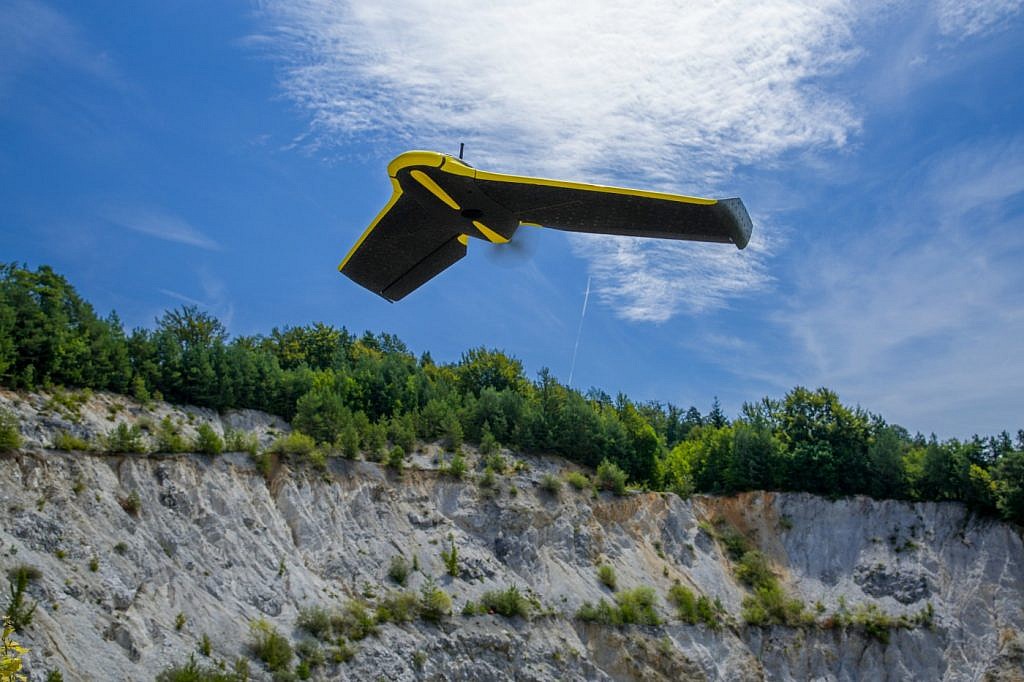
Every time senseFly unmanned aircraft captures a photo, it stops the operation of the engine and stabilized itself, and thus prevents vibrations that would distort the resulting aerial image.

Engine of the senseFly drone is very powerful. In addition to maintaining optimum travelling speed, it takes care of the stabilization of the aircraft, repairs flow because of the wind and breaks during the landing phase. Like all manned aircrafts this unmanned aerial vehicle obtains data on wind speed and direction from a proper scale pitot-static system.

However, if the aircraft due to gusts of wind that affect its orientation cannot capture a certain image, its software informs the operator. But in any case, loss of one or two aerial photographs in a cycle of hundred and more will not cause any damage to the project, and further projects of aerial image processing will not be compromised.

0 Like!
Share
Leave a reply Required fields are marked *

Click here to cancel reply.

Categories

  • Agriculture and Forestry (4)
  • Mapping and Surveying (2)
  • Public Sector (1)
  • Quarries and Open Mines (2)
  • Real Estate (3)
  • Regulations (5)
  • Spatial Research (2)
  • Technology (40)
  • Trends (13)

Archive

  • January 2019 (1)
  • September 2018 (2)
  • June 2018 (1)
  • March 2018 (1)
  • January 2018 (2)
  • December 2017 (1)
  • September 2017 (1)
  • June 2017 (1)
  • May 2017 (2)
  • April 2017 (1)
  • March 2017 (1)
  • February 2017 (1)
  • January 2017 (3)
  • December 2016 (1)
  • November 2016 (1)
  • October 2016 (1)
  • September 2016 (2)
  • August 2016 (1)
  • July 2016 (2)
  • May 2016 (2)
  • April 2016 (1)
  • February 2016 (2)
  • January 2016 (1)
  • December 2015 (1)
  • November 2015 (1)
  • October 2015 (1)
  • September 2015 (2)
  • August 2015 (1)
  • July 2015 (2)
  • May 2015 (1)
  • April 2015 (1)
  • March 2015 (2)
  • February 2015 (3)
  • January 2015 (4)

GEOSPACE

Geospace is Geavis' collection of domestic and foreign web contents describing the adventures of those small civil unmanned drones, the application aspects of aerial photography and geospatial challenges for the benefit of life and business.


View my Flipboard Magazine.

Follow us

LinkedINYouTubeskype

BE INFORMED


We will not spam! Ever! You can unsubscribe any time.
© 2016 Geavis d.o.o.
  • | Cookies Information
  • | Legal Information
  • | Authors
Geavis