+386 1 292 73 90info@geavis.si
SI
logo
Geavis
logo
  • Services
    • Spatial Data Acquisition
    • Advanced Spatial Data Processing
    • Geospatial Analysis
    • Visualizations and Presentations
  • Applications
    • Governmental Institutions and Public Sector
    • Real Estate
    • Mapping and Land Surveying
    • Civil Engineering
    • Industry and Infrastructure
    • Quarries and Open Mines
    • Agriculture and Forestry
    • Insurance
    • Spatial Research
    • Tourism and Promotion
  • Technology
  • Projects
  • Geavis
    • Geavis
    • Clients
    • Contact
  • Blog
  • All
  • Agriculture and Forestry
  • Civil Engineering
  • Governmental Institutions and Public Sector
  • Mapping and Surveying
  • Quarries and Open Mines
  • Real Estate
  • Spatial Research
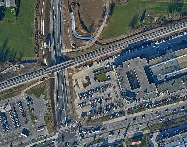
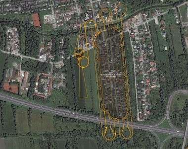
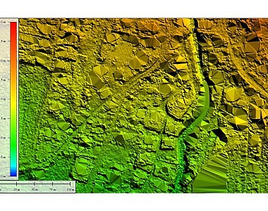
Updated orthophoto mosaic for the area of the new traffic link in the Ljubljana Vič district community
Calculating the volume of waste fractions at the Ljubljana Regional Waste Management Centre
Updated orthophoto mosaic for the area of the renovated Slovenska cesta Road in Ljubljana
Photogrammetric measuring of the volume of a coal landfill
Monitoring the space utilisation in Ljubljana using a small drone
Support for noise study in the area of the new elementary school in the municipality of Grosuplje
Review of space utilisation with a small unmanned aircraft
Land surveying plan of the new situation of the overhead power line route
Flood study data acquisition
Prev.Next
  • 1
  • 2
  • 3

GEOSPACE

Geospace is Geavis' collection of domestic and foreign web contents describing the adventures of those small civil unmanned drones, the application aspects of aerial photography and geospatial challenges for the benefit of life and business.


View my Flipboard Magazine.

Follow us

LinkedINYouTubeskype

BE INFORMED


We will not spam! Ever! You can unsubscribe any time.
© 2016 Geavis d.o.o.
  • | Cookies Information
  • | Legal Information
  • | Authors
Geavis