

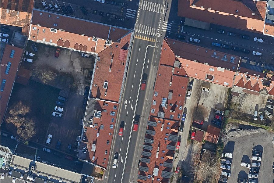
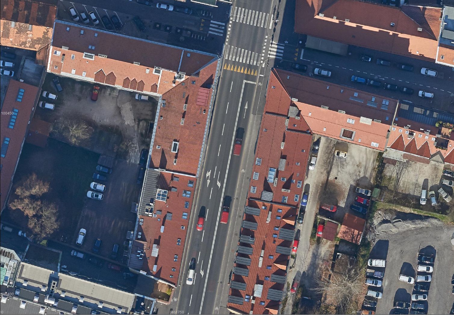
This year, Ljubljana was enhanced by a series of updated roads and other infrastructural facilities, which contribute greatly to the higher quality of life in the city. The new infrastructural assets include the renovated Slovenska cesta Road, which was a project that also involved thorough changes to the traffic system in this area. The new driving lanes for the LPP buses, arranged bicycle lanes and additional surfaces for pedestrians have transformed the area of the Slovenska cesta Road into one of the central public spaces in Slovenia’s capital.
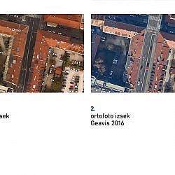
Due to all of the new features and changes in the use of space, revisions had to be made in spatial data as well. The city of Ljubljana decided to bring its infrastructural records up to date since the old ones no longer reflected the actual situation on the site. Geavis was tasked with the renovation of the raster orthophoto layer in the spatial information system of the Ljubljanska parkirišča in tržnice (LPT) company, which needs updated records in carrying out its operations, especially when it comes to maintaining municipal roads and public parking surfaces.
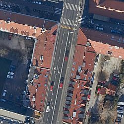
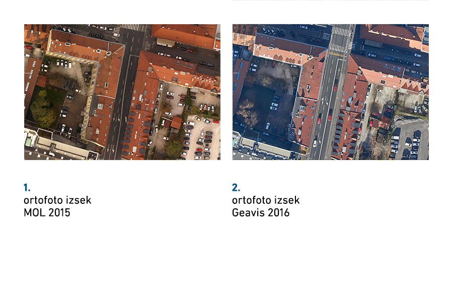
Ljubljana is situated in the area with flight restrictions in place for unmanned aircrafts, i.e. they may only be flown up to the altitude of 50 m, which is lower than some of the buildings. For this reason, aerial photos of the site were taken by Aerovizija, a company licensed for aerial recording with a manned aircraft and at higher altitudes over built-up areas. In collaboration with Aerovizija, we obtained aerial photos for the section of the Slovenska cesta Road between the Aškerčeva ulica Street and the Šubičeva cesta Road. Based on the photos, we created an orthophoto plan of higher quality and resolution in comparison with the existing material; the old orthophoto plan’s resolution was 10 cm/px, while the new plan’s is 5 cm/px. The improved resolution makes it easier to identify details directly from photos and saves us multiple on-site visits that were necessary in the past, when images were of lower quality and needed checking things on the spot.
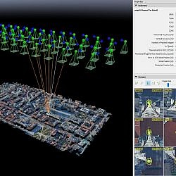
Professional technology of point cloud density enabled us to make a highly detailed digital surface model (DSM), from which we were able to create a true orthophoto, where the objects located above the site are depicted spatially correctly. Among other things, this means that no building is blocking the view of the street, no matter how high. LPT will use the true orthophoto as one of the substantive components within its spatial information system. It brings the company numerous benefits as they can use it to conduct planimetric measurements, place various vector layers on it (e.g. municipal lines) or to cover 3D models, for example.
- Location: the section of the Slovenska cesta Road, Ljubljana
- Area size: 70 ha
- Average GSD: 5 cm
- Resolution: 5 cm/px
- Number of aerial photos: 56
- Number of 3D points: 19.356.405