+386 1 292 73 90info@geavis.si
SI
logo
Geavis
logo
  • Services
    • Spatial Data Acquisition
    • Advanced Spatial Data Processing
    • Geospatial Analysis
    • Visualizations and Presentations
  • Applications
    • Governmental Institutions and Public Sector
    • Real Estate
    • Mapping and Land Surveying
    • Civil Engineering
    • Industry and Infrastructure
    • Quarries and Open Mines
    • Agriculture and Forestry
    • Insurance
    • Spatial Research
    • Tourism and Promotion
  • Technology
  • Projects
  • Geavis
    • Geavis
    • Clients
    • Contact
  • Blog
What is the area that can be imaged by the eBee drone during one flight?
22.04.2017 Technology
What is the area that can be imaged by the eBee drone during one flight?

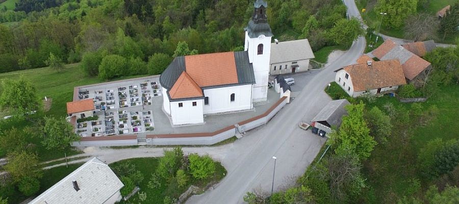
The area size that can be imaged during the flight depends on the flight altitude ...

Continue
How do I find my drone if it flies out of radio range or crashes?
13.03.2017 Technology
How do I find my drone if it flies out of radio range or crashes?

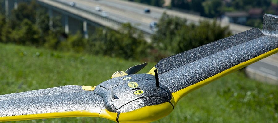
A senseFly drone flying out of radio range poses no problem. It certainly does not usually lead to a crash ...

Continue
Important things to know about the positional accuracy of orthophoto plans produced from aerial photos
25.02.2017 Mapping and Surveying
Important things to know about the positional accuracy of orthophoto plans produced from aerial photos

What sort of accuracy can be expected from an orthophoto plan produced from aerial photos ...

Continue
What happens if the senseFly eBee drone’s radio lock is lost during a flight?
30.01.2017 Technology
What happens if the senseFly eBee drone’s radio lock is lost during a flight?

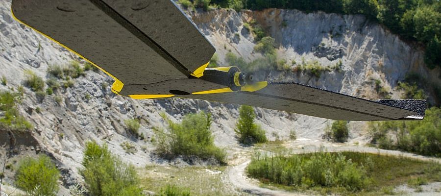
If the drone's radio link is lost, the vast majority of cases this is not a problem ...

Continue
Flying small unmanned aircrafts in cold winter conditions
20.01.2017 Technology
Flying small unmanned aircrafts in cold winter conditions

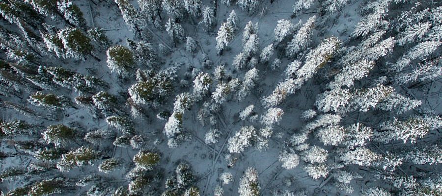
Flying unmanned aircrafts in winter conditions requires more caution than during other seasons ...

Continue
Rules for safe flying and responsible use of unmanned aircrafts
10.01.2017 Regulations
Rules for safe flying and responsible use of unmanned aircrafts

10 essential rules for safe flying set by the Civil Aviation Agency of the Republic of Slovenia (CAA) ...

Continue
At what altitudes can the senseFly eBees unmanned aircraft fly?
17.12.2016 Technology
At what altitudes can the senseFly eBees unmanned aircraft fly?

The eBee, the senseFly unmanned aircraft used by Geavis, has been tested for take-off at up to 4.000 m (13,123 ft) above sea level ...

Continue
Advantages brought by trends in close-range photogrammetry
15.11.2016 Technology
Advantages brought by trends in close-range photogrammetry

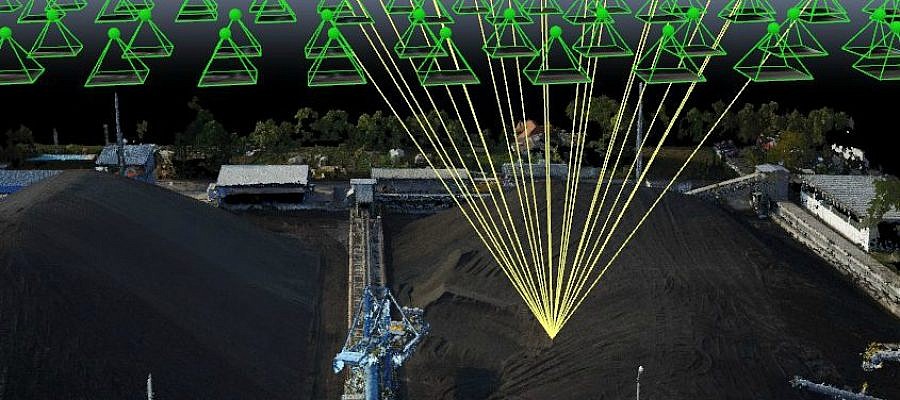
Thanks to progress and digitisation, photogrammetry, once a traditional land surveying method and a science of making measurements from photographs, has been applied in a number of fields ...

Continue
Measures preventing an unmanned aircraft from becoming bird prey
26.10.2016 Technology
Measures preventing an unmanned aircraft from becoming bird prey

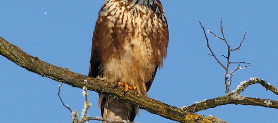
The new technological revolution brought about by the development of unmanned aircrafts raises a number of questions, including how their presence in the air impacts the original inhabitants of air space ...

Continue
The Pix4D innovation: an improved accuracy for rolling shutter cameras
05.09.2016 Technology
The Pix4D innovation: an improved accuracy for rolling shutter cameras

The shutter type of the camera used to acquire imagery can influence the results produced by photogrammetry software. Images taken with rolling shutter cameras, for example, contain a vertical displacement ...

Continue
The difference between an aerial photo and a digital orthophoto
05.09.2016 Technology
The difference between an aerial photo and a digital orthophoto

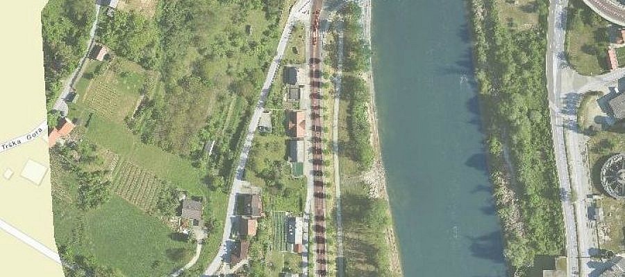
Regular aerial photos are made following the principles of central projection. This means that a photo represents the image of the earth’s surface as observed from a single point ...

Continue
Geavis is one of the first in Slovenia with the CAA certificate of expertise in the rules of flying unmanned aircraft systems
25.08.2016 Regulations
Geavis is one of the first in Slovenia with the CAA certificate of expertise in the rules of flying unmanned aircraft systems

The Regulation of Unmanned Aircraft Systems took effect In the middle of August in Slovenia. It lays down general technical and operative conditions for a safe use ...

Continue
Prev.Next
  • 1
  • 2
  • 3
  • 4
  • 5

Categories

  • Agriculture and Forestry (4)
  • Mapping and Surveying (2)
  • Public Sector (1)
  • Quarries and Open Mines (2)
  • Real Estate (3)
  • Regulations (5)
  • Spatial Research (2)
  • Technology (40)
  • Trends (13)

Archive

  • January 2019 (1)
  • September 2018 (2)
  • June 2018 (1)
  • March 2018 (1)
  • January 2018 (2)
  • December 2017 (1)
  • September 2017 (1)
  • June 2017 (1)
  • May 2017 (2)
  • April 2017 (1)
  • March 2017 (1)
  • February 2017 (1)
  • January 2017 (3)
  • December 2016 (1)
  • November 2016 (1)
  • October 2016 (1)
  • September 2016 (2)
  • August 2016 (1)
  • July 2016 (2)
  • May 2016 (2)
  • April 2016 (1)
  • February 2016 (2)
  • January 2016 (1)
  • December 2015 (1)
  • November 2015 (1)
  • October 2015 (1)
  • September 2015 (2)
  • August 2015 (1)
  • July 2015 (2)
  • May 2015 (1)
  • April 2015 (1)
  • March 2015 (2)
  • February 2015 (3)
  • January 2015 (4)

GEOSPACE

Geospace is Geavis' collection of domestic and foreign web contents describing the adventures of those small civil unmanned drones, the application aspects of aerial photography and geospatial challenges for the benefit of life and business.


View my Flipboard Magazine.

Follow us

LinkedINYouTubeskype

BE INFORMED


We will not spam! Ever! You can unsubscribe any time.
© 2016 Geavis d.o.o.
  • | Cookies Information
  • | Legal Information
  • | Authors
Geavis