+386 1 292 73 90info@geavis.si
SI
logo
Geavis
logo
  • Services
    • Spatial Data Acquisition
    • Advanced Spatial Data Processing
    • Geospatial Analysis
    • Visualizations and Presentations
  • Applications
    • Governmental Institutions and Public Sector
    • Real Estate
    • Mapping and Land Surveying
    • Civil Engineering
    • Industry and Infrastructure
    • Quarries and Open Mines
    • Agriculture and Forestry
    • Insurance
    • Spatial Research
    • Tourism and Promotion
  • Technology
  • Projects
  • Geavis
    • Geavis
    • Clients
    • Contact
  • Blog
Depictions of earth’s surface and visualization of future
Why are GCPs needed in photogrammetry?
Slovenia in the laser scanning data
05.11.2015 Technology

In September 2015, the Ministry of Environment and Spatial Planning began to provide terrain data for the whole of Slovenia. The data required for this purpose has been obtained by collecting the high density terrain elevation data by using the LiDAR earth’s surface laser scanning technique (Light Detection and Ranging). The aim of the project is to provide high quality information on which hydraulic analysis of the water situation, production of flood hazard maps, simulation of flood areas, design of flood-protection measures and planning and spatial planning may mainly be based.Cvinger
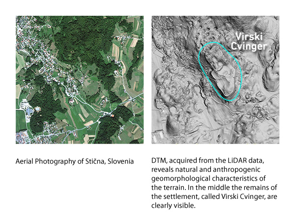
A user can collect georeferenced 3D point cloud for any area in Slovenia and use it for further processing and analysis. LiDAR data are especially useful when large areas of terrain and overgrown grounds come in question.

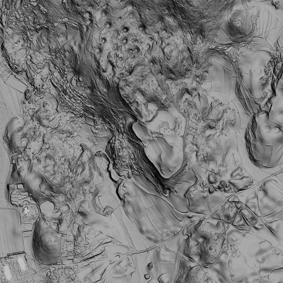
Thanks to a better height precision and the ability to detect and measure objects under vegetation, the now available national LiDAR data are opening up new options of application: from planning, flood studies or studies on geomorphological and topographical changes, archaeology, cultural heritage, vegetation analyses for forestry, environmental protection and ecology, maintenance of electrical power and other purposes.

Please contact the Geavis engineers for more information or a detailed explanation on how to use the newly available data on Slovenian territory in your projects and to achieve your business goals.

Digitalni modeli

4 Like!
Share
Leave a reply Required fields are marked *

Click here to cancel reply.

Categories

  • Agriculture and Forestry (4)
  • Mapping and Surveying (2)
  • Public Sector (1)
  • Quarries and Open Mines (2)
  • Real Estate (3)
  • Regulations (5)
  • Spatial Research (2)
  • Technology (40)
  • Trends (13)

Archive

  • January 2019 (1)
  • September 2018 (2)
  • June 2018 (1)
  • March 2018 (1)
  • January 2018 (2)
  • December 2017 (1)
  • September 2017 (1)
  • June 2017 (1)
  • May 2017 (2)
  • April 2017 (1)
  • March 2017 (1)
  • February 2017 (1)
  • January 2017 (3)
  • December 2016 (1)
  • November 2016 (1)
  • October 2016 (1)
  • September 2016 (2)
  • August 2016 (1)
  • July 2016 (2)
  • May 2016 (2)
  • April 2016 (1)
  • February 2016 (2)
  • January 2016 (1)
  • December 2015 (1)
  • November 2015 (1)
  • October 2015 (1)
  • September 2015 (2)
  • August 2015 (1)
  • July 2015 (2)
  • May 2015 (1)
  • April 2015 (1)
  • March 2015 (2)
  • February 2015 (3)
  • January 2015 (4)

GEOSPACE

Geospace is Geavis' collection of domestic and foreign web contents describing the adventures of those small civil unmanned drones, the application aspects of aerial photography and geospatial challenges for the benefit of life and business.


View my Flipboard Magazine.

Follow us

LinkedINYouTubeskype

BE INFORMED


We will not spam! Ever! You can unsubscribe any time.
© 2016 Geavis d.o.o.
  • | Cookies Information
  • | Legal Information
  • | Authors
Geavis