Professional image processing (photogrammetry) software uses the images captured by drones to generate 3D models and maps, such as professional orthomosaics, point clouds, 3D models and more. This software offers several programs to suit different applications and enable operators to create a range of outputs in industry-standard file formats. The outputs can then be easily imported into third-party software programs for further analysis.
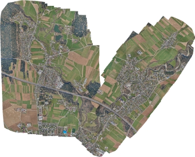
ORTHOMOSAIC RASTER
Outputs:
- GeoTIFF (.tiff)
- KML (.png/.kml)
Compatible with:
- Esri ArcGIS
- Global Mapper
- Google Earth
- QGIS
- Autodesk
- DraftSight
- GeoMedia
- Erdas Imagine
- … and all leading brands of remote sensing & GIS software
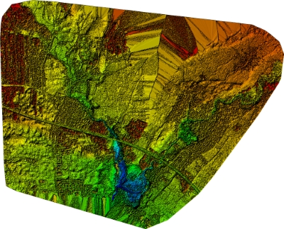
DIGITAL SURFACE MODEL
Outputs:
- GeoTIFF (.tiff)
Compatible with:
- Esri ArcGIS
- Global Mapper
- QGIS
- Quick Terrain
- GeoMedia
- … and all leading brands of GIS software
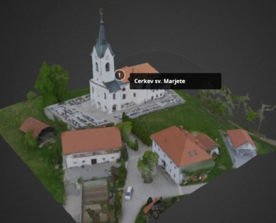
3D TEXTURED MESH
Outputs:
- Wavefront (.obj)
Compatible with:
- Autodesk
- Bentley MicroStation
- ccViewer
- 3DReshaper
- … and all leading brands of 3D modelling software
3D POINT CLOUD
Outputs:
- .las
- .laz
- .ply
- .ascii
Compatible with:
- I-Site Studio
- Esri ArcGIS
- Global Mapper
- Autodesk
- Quick Terrain
- 3DReshaper
- Trimble RealWorks
- Bentley MicroStation
- … and all leading brands of survey and 3D scanning software
GOOGLE MAPS
Outputs:
- KML tiles (.png/.kml)
Compatible with:
- Google Maps
- Mapbox
- … and other map servers
INDEX MAP
Outputs:
- GeoTIFF (.tiff)
- .shp
Compatible with:
- SMS
- AgPixel
- QGIS
- Esri ArcGIS
- Global Mapper
- … and all leading brands of GIS software
CONTOUR LINES
Outputs:
- .dxf
- .shp
Compatible with:
- Vulcan
- I-Site Studio
- Autodesk
- DraftSight
- QGIS
- Esri ArcGIS
- Surpac
- … and all leading brands of survey software
UNDISTORTED AERIAL IMAGES
Outputs:
- .tif
Compatible with:
- Trimble Inpho
- Socet Set
- Imagine Photogrammetry
- … and many other brands of photogrammetry software