Ground Control Points (GCP) are points on the ground with known coordinates in the spatial coordinate system (i.e. both coordinates defining horizontal position and the altitude coordinate). Their coordinates are obtained with traditional surveying methods in the field (tachymetry, GNSS-measurement) or from other available sources.
The GCP in nature determines the position of its aerial photo mage in the coordinate system. To calculate the coordinates for each point on the aerial photography, several ground control points’ coordinates are used and photogrammetric procedures followed.
GCPs are necessary for orientation and placement of aerial photographs in the spatial coordinate system, which is a prerequisite for the production of georeferenced metric and 3D models of the earth’s surface (point cloud, DSM, DTM, orthophoto plan). Namely, computer processing and analysis require spatial coordination models – from point cloud to orthophoto mosaics.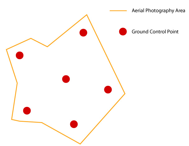 In practice – even for large areas of the field – it is sufficient to use from 5 to 10 ground control points. Using a larger number of points does not significantly contribute to a higher accuracy. The more the terrain is naturally varied, the higher number of ground control points are necessary to achieve the desired accuracy.
In the field, ground control points are marked in a way that makes them visible later on aerial photographs. Then they are arranged along the edges of areas in question. In practice, all but one are placed on the characteristic points of the terrain polygon; the resting one is placed exactly in the middle of the polygon. Each ground control point must be visible in at least two aerial photographs, or best on five for optimum results. Therefore, the points should better not be located right at the edge of the area; if so, they will only be visible on few aerial photographs.