Regular aerial photos are made following the principles of central projection. This means that a photo represents the image of the earth’s surface as observed from a single point, i.e. the projection centre. The latter is the optical centre of the camera lens. All rays of light that fall onto the photo (film or a digital sensor) converge in this point.
V centralni projekciji so objekti, ki so horizontalno na isti, višinsko pa na različnih pozicijah zaradi razgibanega terena, na posnetku prikazani na različnih položajih. To se na posnetku pokaže kot premik reliefa (t.i. radialna deformacija).
In central projection, the objects that are in the same position horizontally, but in different positions in terms of height due to a dynamic landscape, are displayed in different positions in the photo. In the photo, this is shown as the relief displacement (i.e. radial deformation).
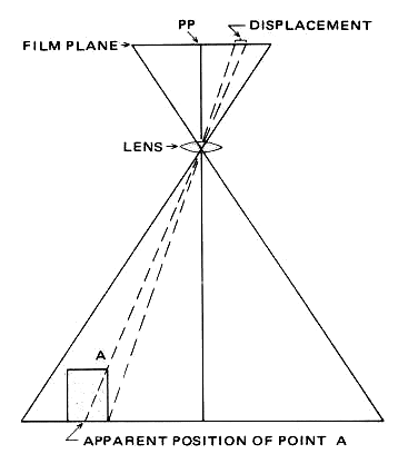
In addition to the relief displacement, the central projection has another weakness, namely that the objects which are closer to the projection centre are displayed in a larger scale than those that are farther away from it. Aerial photos therefore do not feature a unified scale; the height difference in the position of the object on the landscape causes the size of the object on the aerial photo to seemingly change. Aerial photos therefore cannot be used for planimetric measurements as all essential geometric elements such as distances, angles and surfaces are distorted.
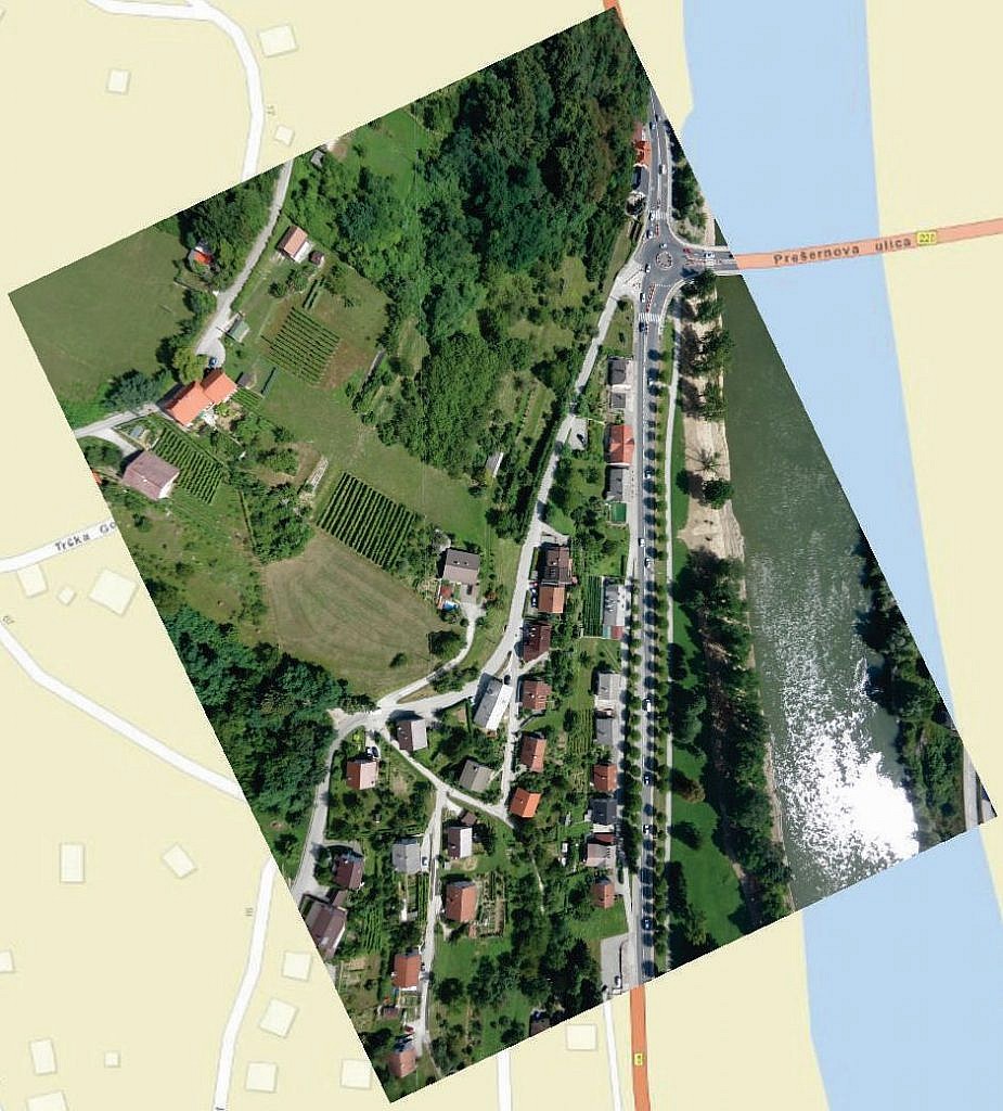
The aerial photo (the Sava river embankment in the vicinity of Krško) does not precisely match the map underneath.
It is evident that roads and facilities are tilted.
Through an orthophoto procedure, the aerial photo can be converted from central to orthogonal projection, thus largely eliminating the above-referenced weaknesses of central projection. An orthophoto is therefore an aerial photo converted into orthogonal projection by taking into account data on the relief and the absolute orientation of aerial photos. The terrain area on an orthophoto is displayed in a unified scale. In the metric sense, an orthophoto is the same as a line plan or map, and corresponds to the map in the same scale. Since it contains no distortions, an orthophoto enables precise measurements of distances, angles and surfaces, and transferring the situation to maps by means of simple minimization or maximization. It can also be combined with information from maps (e.g. adding contour lines etc.), thus combining elements of the aerial photo and the map.
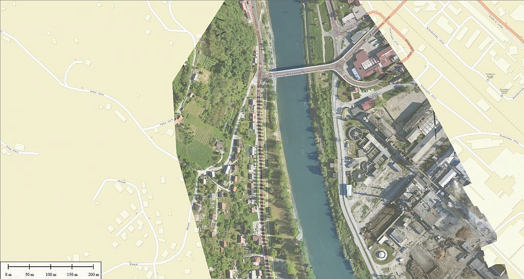
The orthophoto (the Sava river embankment in the vicinity of Krško) matches the map underneath.