+386 1 292 73 90info@geavis.si
SI
logo
Geavis
logo
  • Services
    • Spatial Data Acquisition
    • Advanced Spatial Data Processing
    • Geospatial Analysis
    • Visualizations and Presentations
  • Applications
    • Governmental Institutions and Public Sector
    • Real Estate
    • Mapping and Land Surveying
    • Civil Engineering
    • Industry and Infrastructure
    • Quarries and Open Mines
    • Agriculture and Forestry
    • Insurance
    • Spatial Research
    • Tourism and Promotion
  • Technology
  • Projects
  • Geavis
    • Geavis
    • Clients
    • Contact
  • Blog
Civil Aviation Agency confirmed Geavis` Operations Manual
How can a lightweight unmanned aircraft be stable enough to capture high resolution aerial photos?
Geavis aerial photography in the annual report of Petrol
09.05.2016 Real Estate

DCIM100MEDIADJI_0146.JPG

In creative design of the annual report for its client, the largest Slovenian energy company Petrol d.d., SM Studio Marketing planned a photographic material that would display a wide range and diversity of the activities of the client.

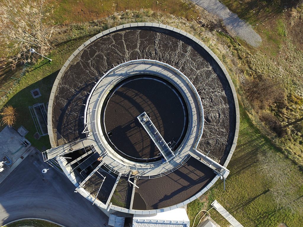
The idea of the marketing agency was to obtain attractive and quality images of Petrol facilities from the air, but from unexpected angles and from a minimum distance. From the contractor they expected technical knowledge and skills as well as a sense of aesthetics and creativity. According to these criteria, SM Studio Marketing selected Geavis to carry our aerial photography.

Geavis carried out panoramic aerial photography of Petrol`s business facilities at various locations across Slovenia: in Ljubljana and its surroundings, Ihan, Brežice, Sežana and Trebnje. Using unmanned drone it obtained over 250 aerial photos, of which SM Studio Marketing prepared a selection to design Petrol`s annual report 2015.

0 Like!
Share
Leave a reply Required fields are marked *

Click here to cancel reply.

Categories

  • Agriculture and Forestry (4)
  • Mapping and Surveying (2)
  • Public Sector (1)
  • Quarries and Open Mines (2)
  • Real Estate (3)
  • Regulations (5)
  • Spatial Research (2)
  • Technology (40)
  • Trends (13)

Archive

  • January 2019 (1)
  • September 2018 (2)
  • June 2018 (1)
  • March 2018 (1)
  • January 2018 (2)
  • December 2017 (1)
  • September 2017 (1)
  • June 2017 (1)
  • May 2017 (2)
  • April 2017 (1)
  • March 2017 (1)
  • February 2017 (1)
  • January 2017 (3)
  • December 2016 (1)
  • November 2016 (1)
  • October 2016 (1)
  • September 2016 (2)
  • August 2016 (1)
  • July 2016 (2)
  • May 2016 (2)
  • April 2016 (1)
  • February 2016 (2)
  • January 2016 (1)
  • December 2015 (1)
  • November 2015 (1)
  • October 2015 (1)
  • September 2015 (2)
  • August 2015 (1)
  • July 2015 (2)
  • May 2015 (1)
  • April 2015 (1)
  • March 2015 (2)
  • February 2015 (3)
  • January 2015 (4)

GEOSPACE

Geospace is Geavis' collection of domestic and foreign web contents describing the adventures of those small civil unmanned drones, the application aspects of aerial photography and geospatial challenges for the benefit of life and business.


View my Flipboard Magazine.

Follow us

LinkedINYouTubeskype

BE INFORMED


We will not spam! Ever! You can unsubscribe any time.
© 2016 Geavis d.o.o.
  • | Cookies Information
  • | Legal Information
  • | Authors
Geavis