+386 1 292 73 90info@geavis.si
SI
logo
Geavis
logo
  • Services
    • Spatial Data Acquisition
    • Advanced Spatial Data Processing
    • Geospatial Analysis
    • Visualizations and Presentations
  • Applications
    • Governmental Institutions and Public Sector
    • Real Estate
    • Mapping and Land Surveying
    • Civil Engineering
    • Industry and Infrastructure
    • Quarries and Open Mines
    • Agriculture and Forestry
    • Insurance
    • Spatial Research
    • Tourism and Promotion
  • Technology
  • Projects
  • Geavis
    • Geavis
    • Clients
    • Contact
  • Blog
How are true orthophoto mosaics made?
Slovenia in the laser scanning data
Depictions of earth’s surface and visualization of future
29.10.2015 Technology

Any construction of new facilities requires intense preparations, in particular when speaking about business premises, infrastructure or facilities of wider social importance. New buildings may cause adverse effects on the environment or vice versa. Thus, since the existing environment can have inappropriate influence on new constructions, a proper visualization of new buildings simulating the interactions between the environment and the new construction shall already be created at the stage of preparation of the documentation in question. In this way, the best insight into new construction is provided and a variety of studies on local interactions can be produced.

Tepanje_DMR

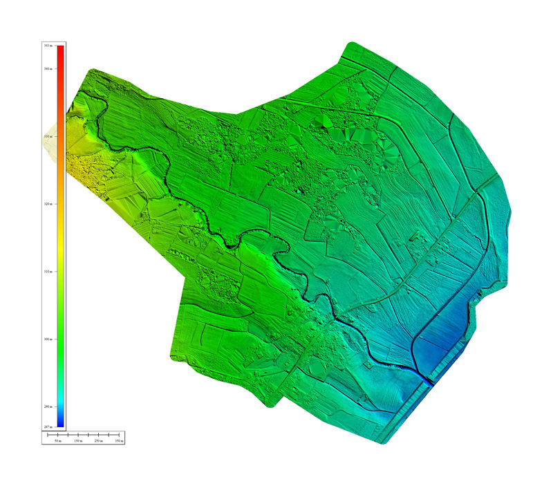
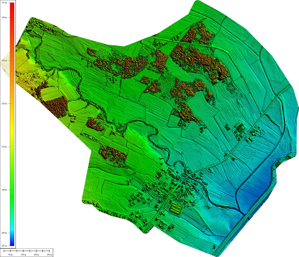
In order to implement visualizations, simulations and studies, the data concerning the existing site shall already be obtained at the initial stage. Here, our aerial photography technologies assist effectively with capturing different types of spatial data from the air. With the aerial photographs obtained through our photogrammetric processes in advanced step-by-step processing, we produce 2D or 3D digital raster and metric models. Based on these, we classify or filter the objects of our interest: buildings, vegetation, infrastructure, plain surface, etc. Whether DTM (digital terrain models), DEM (digital elevation models), or DMO (digital object models) etc., the resulting models provide the ideal basis for geospatial analysis. These results in derived models, such as:

  • shaded earth surface model
  • geomorphological model
  • hydrological model
  • erosion model
  • etc.

All of these models can be used for trend prediction and simulation, which include simulations of landslides, erosion, emissions, floods, noise, sunshine … and many other phenomena and impacts important to be acquainted with and consider when performing interventions in space.


Tepanje_DSM

0 Like!
Share
Leave a reply Required fields are marked *

Click here to cancel reply.

Categories

  • Agriculture and Forestry (4)
  • Mapping and Surveying (2)
  • Public Sector (1)
  • Quarries and Open Mines (2)
  • Real Estate (3)
  • Regulations (5)
  • Spatial Research (2)
  • Technology (40)
  • Trends (13)

Archive

  • January 2019 (1)
  • September 2018 (2)
  • June 2018 (1)
  • March 2018 (1)
  • January 2018 (2)
  • December 2017 (1)
  • September 2017 (1)
  • June 2017 (1)
  • May 2017 (2)
  • April 2017 (1)
  • March 2017 (1)
  • February 2017 (1)
  • January 2017 (3)
  • December 2016 (1)
  • November 2016 (1)
  • October 2016 (1)
  • September 2016 (2)
  • August 2016 (1)
  • July 2016 (2)
  • May 2016 (2)
  • April 2016 (1)
  • February 2016 (2)
  • January 2016 (1)
  • December 2015 (1)
  • November 2015 (1)
  • October 2015 (1)
  • September 2015 (2)
  • August 2015 (1)
  • July 2015 (2)
  • May 2015 (1)
  • April 2015 (1)
  • March 2015 (2)
  • February 2015 (3)
  • January 2015 (4)

GEOSPACE

Geospace is Geavis' collection of domestic and foreign web contents describing the adventures of those small civil unmanned drones, the application aspects of aerial photography and geospatial challenges for the benefit of life and business.


View my Flipboard Magazine.

Follow us

LinkedINYouTubeskype

BE INFORMED


We will not spam! Ever! You can unsubscribe any time.
© 2016 Geavis d.o.o.
  • | Cookies Information
  • | Legal Information
  • | Authors
Geavis