+386 1 292 73 90info@geavis.si
SI
logo
Geavis
logo
  • Services
    • Spatial Data Acquisition
    • Advanced Spatial Data Processing
    • Geospatial Analysis
    • Visualizations and Presentations
  • Applications
    • Governmental Institutions and Public Sector
    • Real Estate
    • Mapping and Land Surveying
    • Civil Engineering
    • Industry and Infrastructure
    • Quarries and Open Mines
    • Agriculture and Forestry
    • Insurance
    • Spatial Research
    • Tourism and Promotion
  • Technology
  • Projects
  • Geavis
    • Geavis
    • Clients
    • Contact
  • Blog
Accurate data from the air, when you need them
07.09.2015 Technology
Accurate data from the air, when you need them

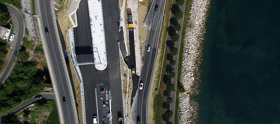
Modern geographic information systems have changed the way we work, make decisions, and change the world around us. Every moment, we have access to an endless number of geographic data ...

Continue
How a panoramic photograph is made by using a drone?
10.08.2015 Technology
How a panoramic photograph is made by using a drone?

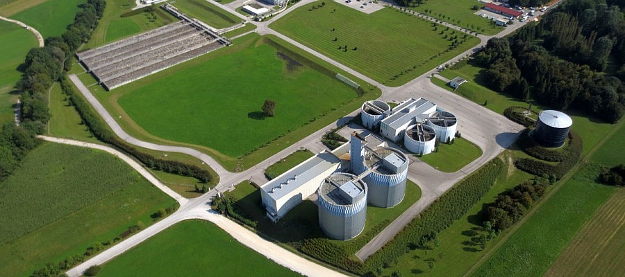
When taking aerial photographs by using a drone, we are faced with restrictions that are associated with such manner of flying. The camera, which is typically installed into the airframe ...

Continue
Spectral recording of vegetation
12.07.2015 Agriculture and Forestry
Spectral recording of vegetation

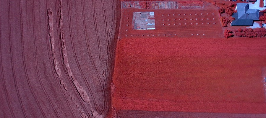
There is a wide range of cameras which can be fitted to a drone. NIR-cameras capture image data in the infrared portion of electromagnetic spectrum and are used primarily ...

Continue
Studying vegetation from aerial photographs
08.07.2015 Agriculture and Forestry
Studying vegetation from aerial photographs

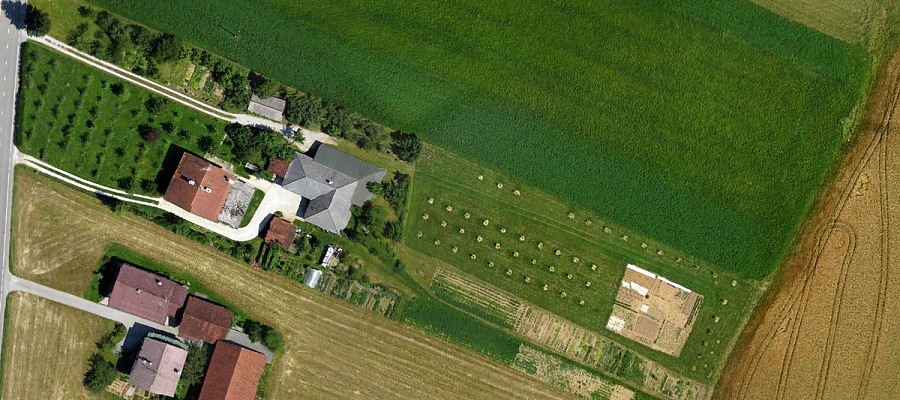
Obtaining data on farmland with high resolution aerial photography is becoming more commonly used in agronomy since the aerial photographs are the most up-to-date and objective document that ...

Continue
How does the senseFly eBee unmanned aircraft take off and land?
25.05.2015 Technology
How does the senseFly eBee unmanned aircraft take off and land?

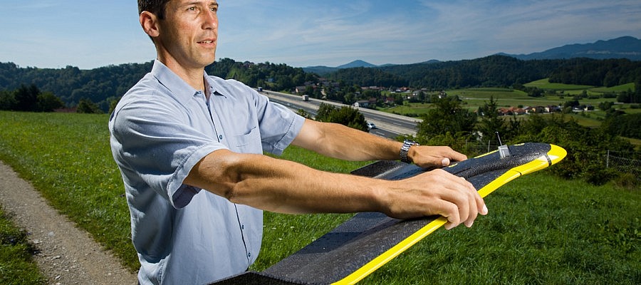
The senseFly eBee unmanned aircraft used by Geavis takes off from the operator’s hand after being directed against the wind in order to limit the necessary ground velocity. The aircraft’s ...

Continue
Unmanned aircrafts in aid of town planning
22.04.2015 Public Sector
Unmanned aircrafts in aid of town planning

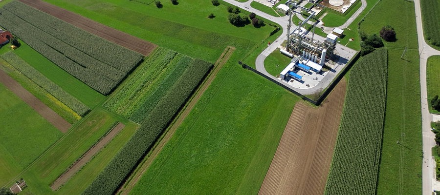
Aerial photos (especially orthophotos) have been used in town and spatial planning for many years. Since the appearance of small unmanned aircrafts, this technology can be used in a more ...

Continue
The course of planning an unmanned aircraft flight
20.03.2015 Technology
The course of planning an unmanned aircraft flight

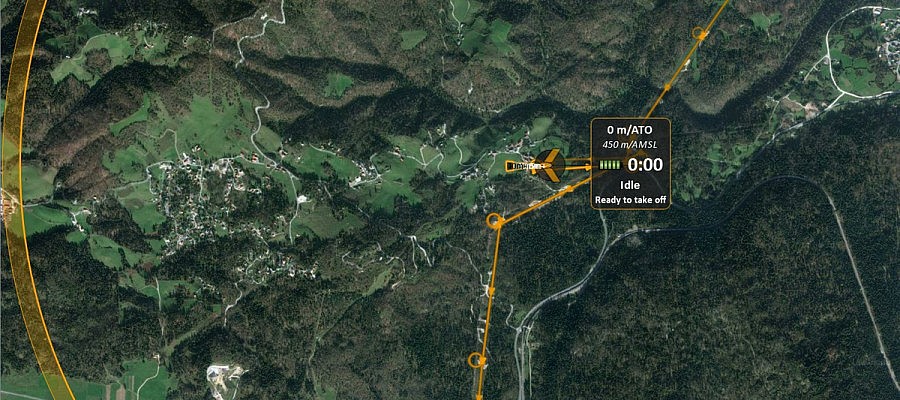
An unmanned aircraft operator monitors the flight by means of specialist software installed on a laptop. Prior to take-off, the operator must first prepare a flight plan, whereby the input ...

Continue
Unmanned aircrafts in land surveying
16.03.2015 Mapping and Surveying
Unmanned aircrafts in land surveying

There are many reasons why unmanned aircrafts have become a very effective land surveying tool. First of all, they undoubtedly reduce the time needed to obtain accurate data. The georeferenced ...

Continue
How is aerial photography undertaken in hilly areas?
20.02.2015 Technology
How is aerial photography undertaken in hilly areas?

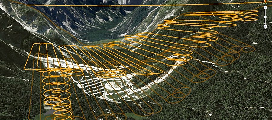
When it comes to aerial photography, hilly areas represent a special challenge. The camera acquires an image of the landscape in a fashion similar to that of the human eye ...

Continue
SenseFly eBee user receives rare FAA exemption
15.02.2015 Agriculture and Forestry
SenseFly eBee user receives rare FAA exemption

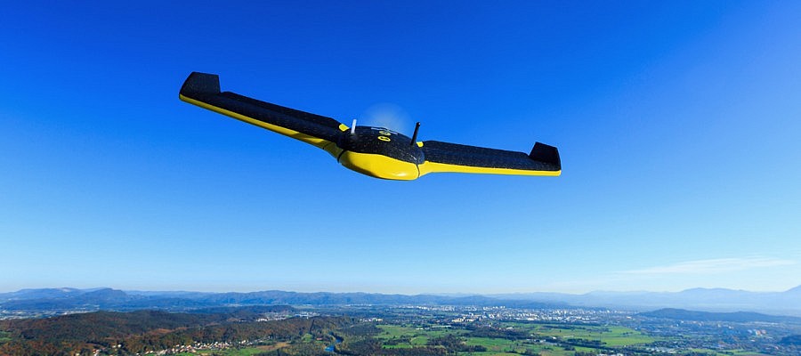
Great news from over the pond. American service company Advanced Aviation Solutions this month received a rare exemption to fly a drone commercially, from the US aviation authority, the FAA ...

Continue
Drones helpfully utilized in agriculture
10.02.2015 Agriculture and Forestry
Drones helpfully utilized in agriculture

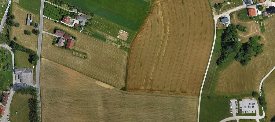
Obtaining data on agricultural surfaces by means of high-resolution aerial photography is becoming an increasingly economic solution as it is a safe and quickly realizable method that can be applied ...

Continue
What are the capacities of senseFly eBee unmanned aerial vehicle?
15.01.2015 Technology
What are the capacities of senseFly eBee unmanned aerial vehicle?

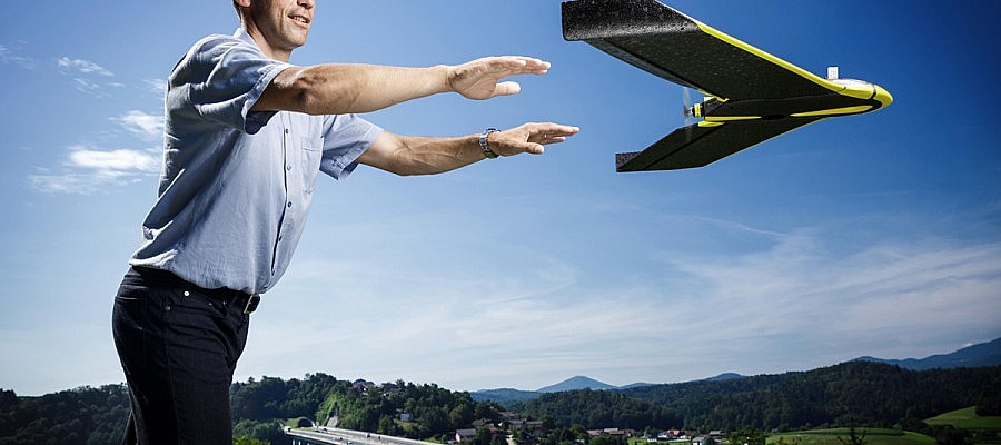
Geavis uses senseFly eBee unmanned aerial vehicle whose flight endurance with a full battery is for about 45 minutes, and during that time it can overfly 30 km. By replacing ...

Continue
Prev.Next
  • 1
  • 2
  • 3
  • 4
  • 5

Categories

  • Agriculture and Forestry (4)
  • Mapping and Surveying (2)
  • Public Sector (1)
  • Quarries and Open Mines (2)
  • Real Estate (3)
  • Regulations (5)
  • Spatial Research (2)
  • Technology (40)
  • Trends (13)

Archive

  • January 2019 (1)
  • September 2018 (2)
  • June 2018 (1)
  • March 2018 (1)
  • January 2018 (2)
  • December 2017 (1)
  • September 2017 (1)
  • June 2017 (1)
  • May 2017 (2)
  • April 2017 (1)
  • March 2017 (1)
  • February 2017 (1)
  • January 2017 (3)
  • December 2016 (1)
  • November 2016 (1)
  • October 2016 (1)
  • September 2016 (2)
  • August 2016 (1)
  • July 2016 (2)
  • May 2016 (2)
  • April 2016 (1)
  • February 2016 (2)
  • January 2016 (1)
  • December 2015 (1)
  • November 2015 (1)
  • October 2015 (1)
  • September 2015 (2)
  • August 2015 (1)
  • July 2015 (2)
  • May 2015 (1)
  • April 2015 (1)
  • March 2015 (2)
  • February 2015 (3)
  • January 2015 (4)

GEOSPACE

Geospace is Geavis' collection of domestic and foreign web contents describing the adventures of those small civil unmanned drones, the application aspects of aerial photography and geospatial challenges for the benefit of life and business.


View my Flipboard Magazine.

Follow us

LinkedINYouTubeskype

BE INFORMED


We will not spam! Ever! You can unsubscribe any time.
© 2016 Geavis d.o.o.
  • | Cookies Information
  • | Legal Information
  • | Authors
Geavis