+386 1 292 73 90info@geavis.si
SI
logo
Geavis
logo
  • Services
    • Spatial Data Acquisition
    • Advanced Spatial Data Processing
    • Geospatial Analysis
    • Visualizations and Presentations
  • Applications
    • Governmental Institutions and Public Sector
    • Real Estate
    • Mapping and Land Surveying
    • Civil Engineering
    • Industry and Infrastructure
    • Quarries and Open Mines
    • Agriculture and Forestry
    • Insurance
    • Spatial Research
    • Tourism and Promotion
  • Technology
  • Projects
  • Geavis
    • Geavis
    • Clients
    • Contact
  • Blog
Point cloud fly-through animation
Drones helpfully utilized in agriculture
What are the capacities of senseFly eBee unmanned aerial vehicle?
15.01.2015 Technology

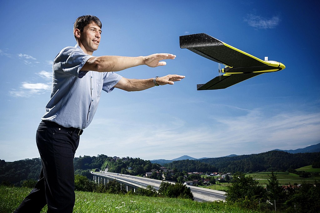
Geavis uses senseFly eBee unmanned aerial vehicle whose flight endurance with a full battery is for about 45 minutes, and during that time it can overfly 30 km. By replacing the batteries, the time in service can be prolonged and the aerial photographing can cover an area to 10 km2. The flight endurance is reduced by the wind, frequent changes in the height levels or very low temperatures. The travel speed of the aerial vehicle is typically 36-57 km/h (10-16 m/s), while the take-up rate is approximately 3 m/s. To perform the intended flight, the aerial vehicle needs only locally favourable weather conditions in the area of taking the aerial photographs: cloud base of 300 m above the ground level and absence of stronger winds. Maximum wind speed which still allows the aerial vehicle to fly is 45 km/h (12 m/s). During such a wind it is guaranteed that the aerial vehicle can be returned to its take-off place when the sensors of aerial vehicle detect stronger winds.

Geavis

0 Like!
Share
Leave a reply Required fields are marked *

Click here to cancel reply.

Categories

  • Agriculture and Forestry (4)
  • Mapping and Surveying (2)
  • Public Sector (1)
  • Quarries and Open Mines (2)
  • Real Estate (3)
  • Regulations (5)
  • Spatial Research (2)
  • Technology (40)
  • Trends (13)

Archive

  • January 2019 (1)
  • September 2018 (2)
  • June 2018 (1)
  • March 2018 (1)
  • January 2018 (2)
  • December 2017 (1)
  • September 2017 (1)
  • June 2017 (1)
  • May 2017 (2)
  • April 2017 (1)
  • March 2017 (1)
  • February 2017 (1)
  • January 2017 (3)
  • December 2016 (1)
  • November 2016 (1)
  • October 2016 (1)
  • September 2016 (2)
  • August 2016 (1)
  • July 2016 (2)
  • May 2016 (2)
  • April 2016 (1)
  • February 2016 (2)
  • January 2016 (1)
  • December 2015 (1)
  • November 2015 (1)
  • October 2015 (1)
  • September 2015 (2)
  • August 2015 (1)
  • July 2015 (2)
  • May 2015 (1)
  • April 2015 (1)
  • March 2015 (2)
  • February 2015 (3)
  • January 2015 (4)

GEOSPACE

Geospace is Geavis' collection of domestic and foreign web contents describing the adventures of those small civil unmanned drones, the application aspects of aerial photography and geospatial challenges for the benefit of life and business.


View my Flipboard Magazine.

Follow us

LinkedINYouTubeskype

BE INFORMED


We will not spam! Ever! You can unsubscribe any time.
© 2016 Geavis d.o.o.
  • | Cookies Information
  • | Legal Information
  • | Authors
Geavis