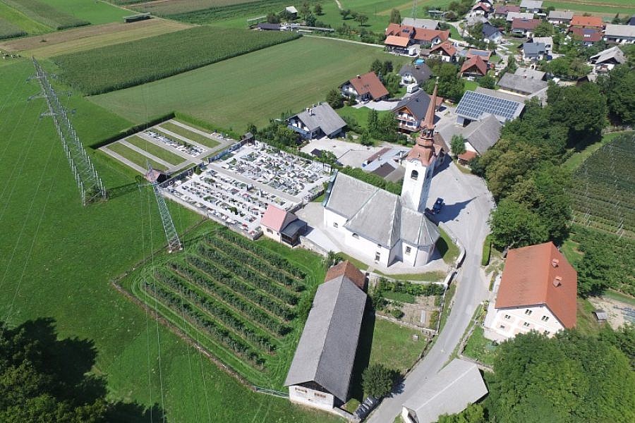
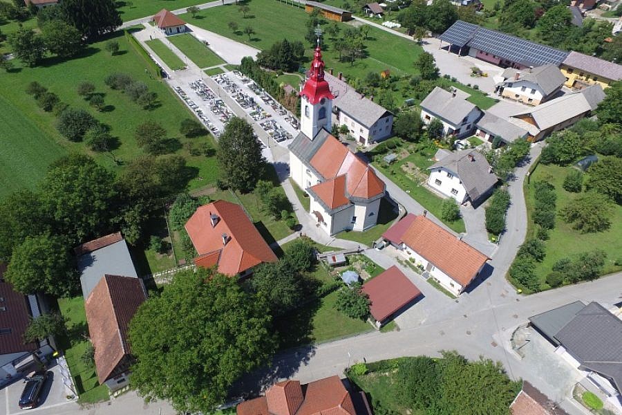
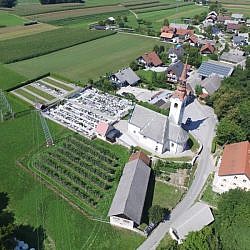
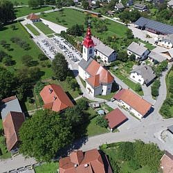
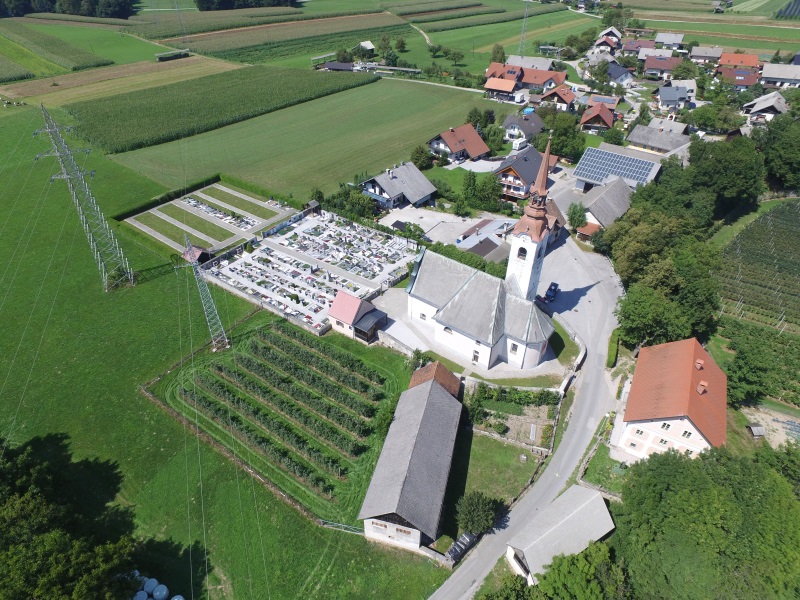
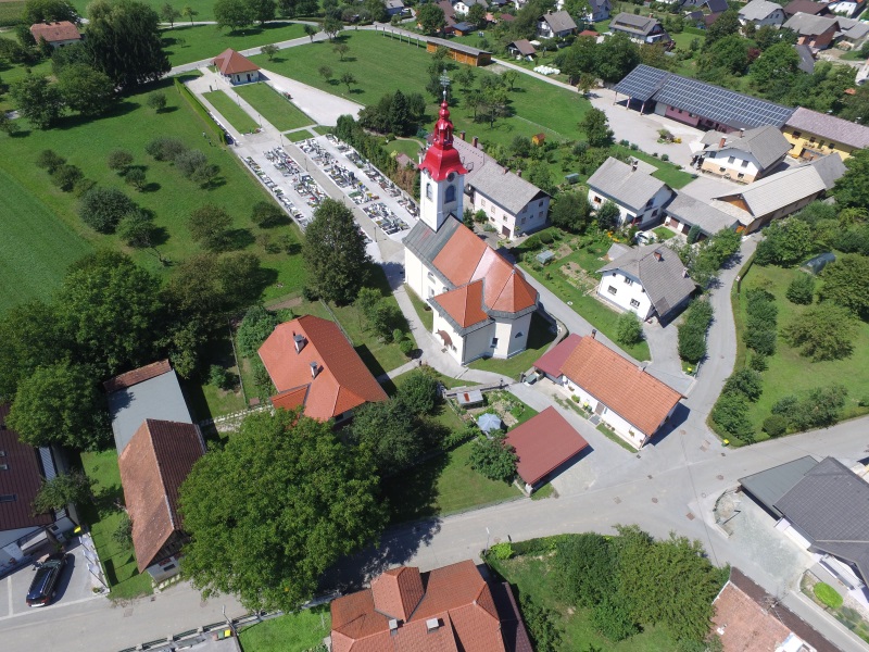
Realis, the developer of software solutions in spatial information systems, turned to Geavis for aerial survey and the production of new orthophoto maps for the spatial information system of municipalities PISO. It is about updating orthophoto plans of cemeteries in the settlements of Naklo, Spodnje Duplje and Podbrezje, which are already included in the Realis application PISO Cemeteries. It is a module that enables municipalities and their municipal companies to manage and keep records of cemetery data.
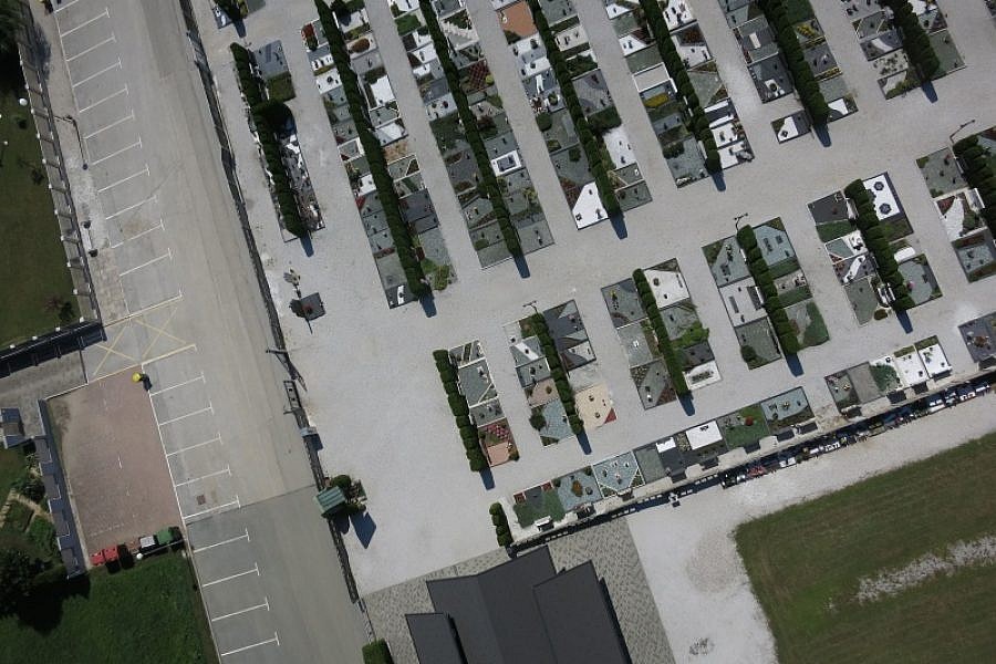
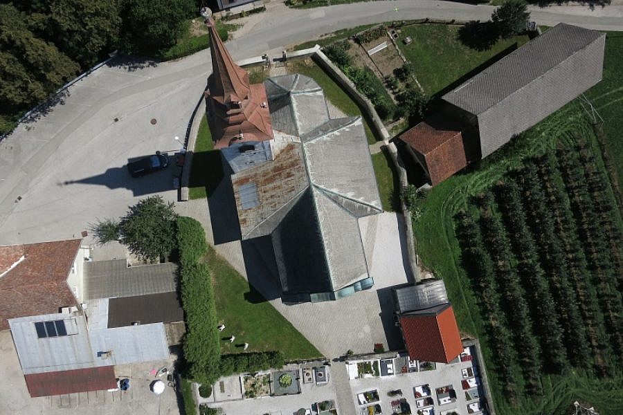
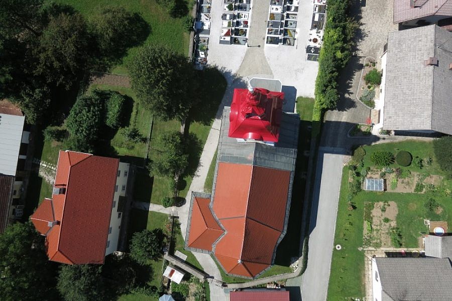
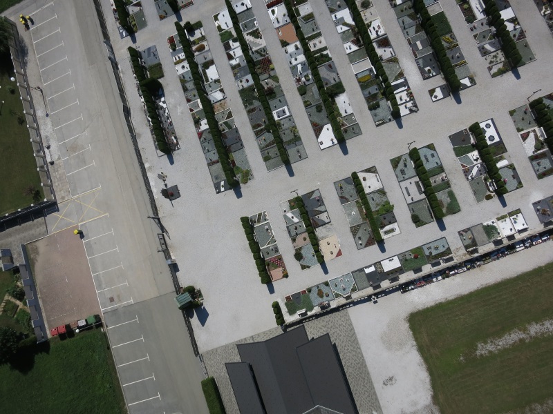
Since quality graphic displays are important for the PISO system, the customer’s expectations were to obtain high-quality orthophoto groundwork of high resolution and accuracy. Geavis achieved this by deliberate planning and careful aerial photography. Since the height of the flight, required to achieve high resolution, did not allow high overlapping of aerial photographs (75% – 80% coverage should be required), aerial photography was carried out using a special method of cross-crossing the area of cemeteries. This allowed us to achieve the high accuracy of geospatial data.
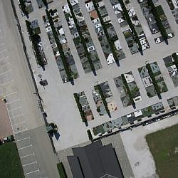
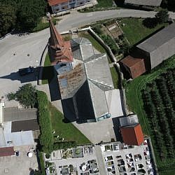
By aerial photography of the cemetery area we obtained high-resolution photos from which we could produce a planar orthophoto map with better quality and higher resolution than old materials – the new orthophoto map has a resolution of as much as 2 cm/px.
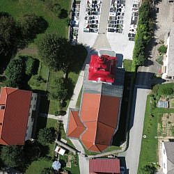
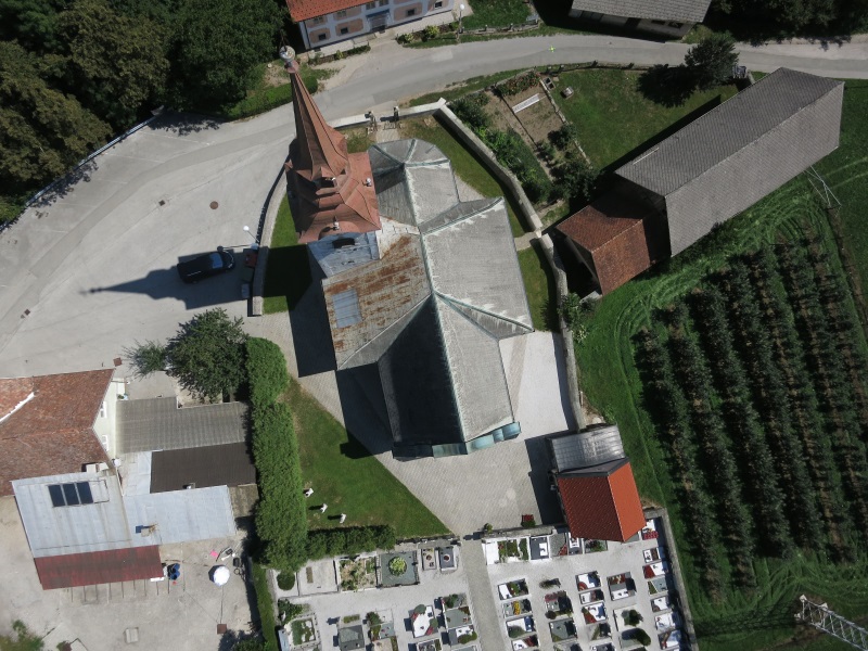
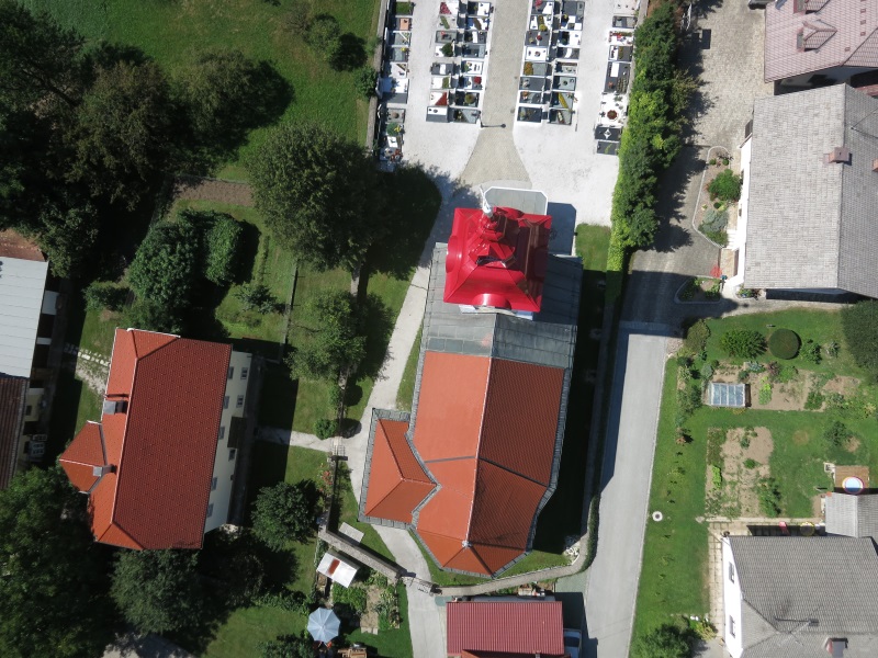
With the cloud dots thickening procedures we could produce a very precise digital surface model (DMP) and from it a complete orthophoto map (true orthophoto) of a particular cemetery. Thus we could achieve the absolute orthogonality of the cemetery facilities, for example cemetery fences, church bell towers, mortuary roofs and other facilities. All of these objects are only visible from the bird’s-eye view on the new orthophoto map, while their lateral walls are not shown in the pictures and do not obscure the view of the graves surrounding.
The updated orthophoto maps are an important element in the spatial information system PISO Cemeteries. For its efficient operation in the management of data on graves, their tenants, calculation of rents and other services the acquired quality geospatial data is of key importance for users in municipalities and their municipal companies.
- Location: cemeteries in the settlements of Naklo, Spodnje Duplje and Podbrezje, Slovenia
- Area size: 3 x 2 ha
- Average GSD: 2 cm
- Resolution: 1.8 cm/px
- Number of aerial photos:
- Naklo cemetery: 117
- Podbrezje cemetery: 114
- Spodnje Duplje cemetery: 134
- Number of 3D points:
- Naklo cemetery: 11.500.000
- Podbrezje cemetery: 9.000.000
- Spodnje Duplje cemetery: 11.500.000