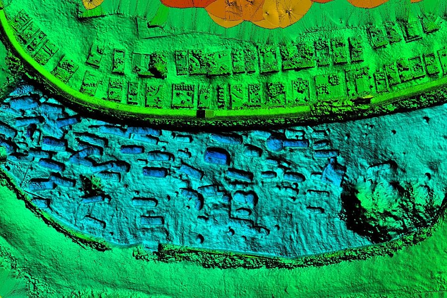
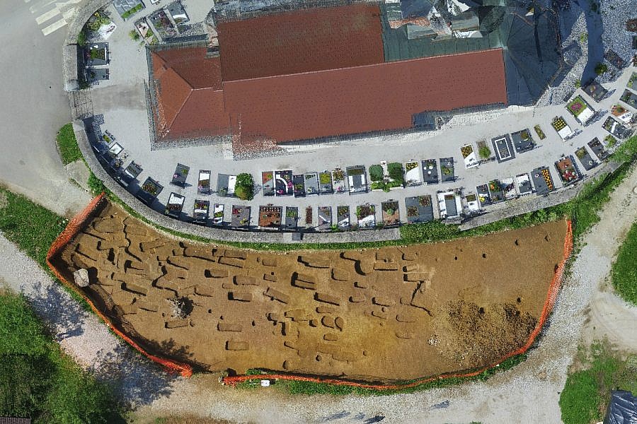
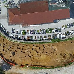
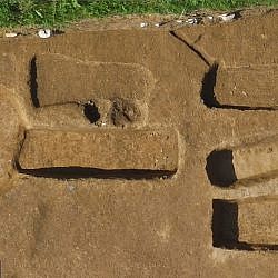
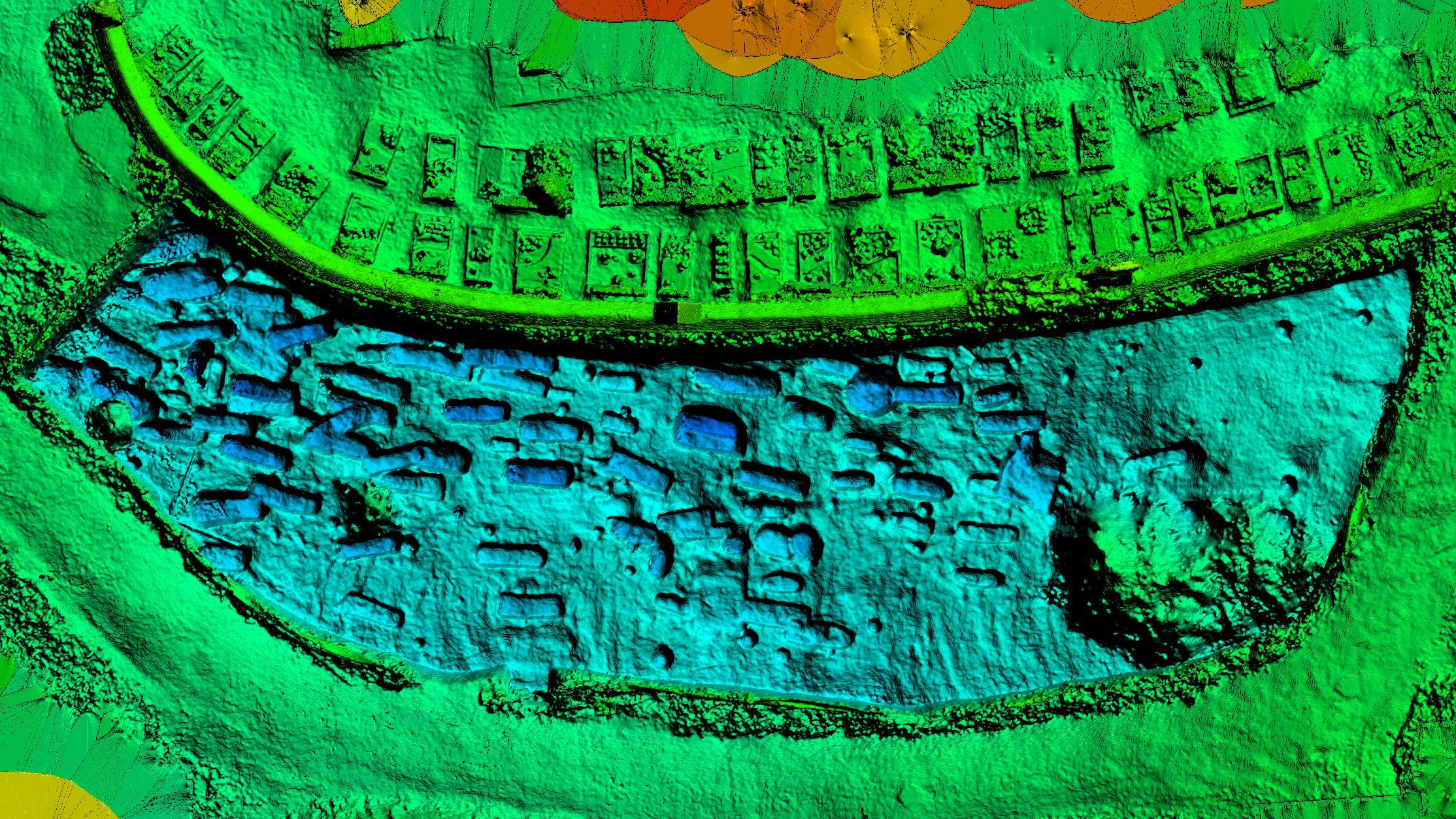
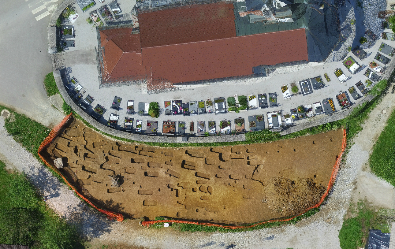
This year’s spring saw archaeological digs taking place in the vicinity of the existing Muljava cemetery. Next to the Church of the Assumption of Mary, where there used to be a prehistoric settlement, archaeologists are now researching the burial ground of the Early Slavs dating back to app. 1000 years BC.
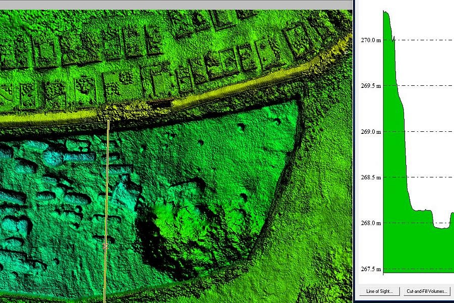
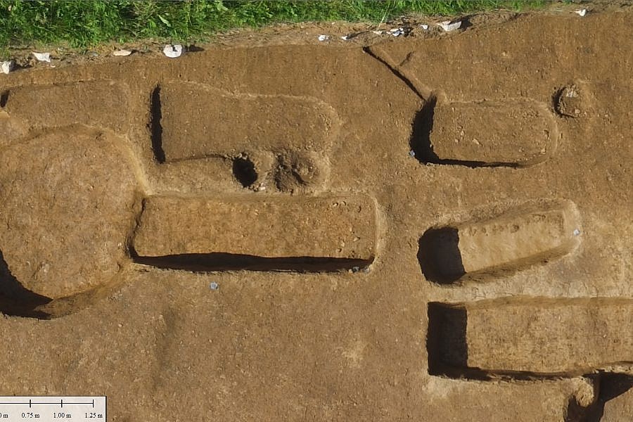
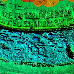
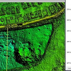
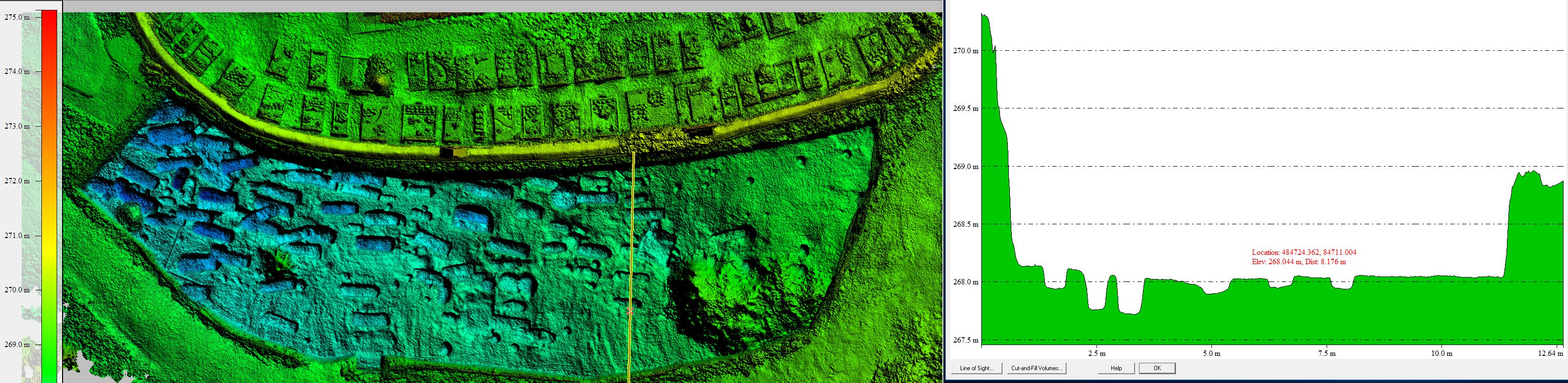
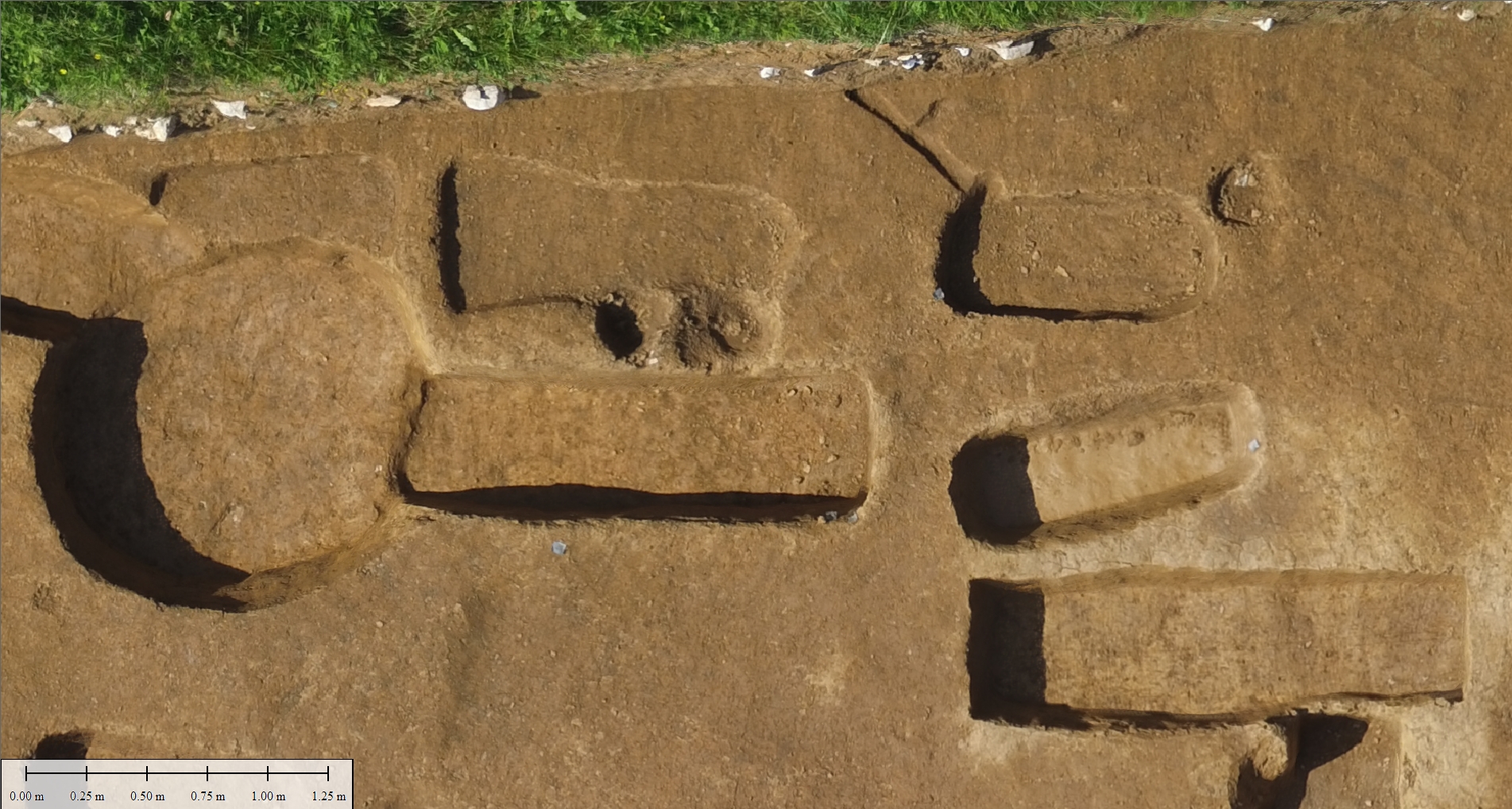
Geavis was tasked with documenting the discovered archaeological site, for which we chose an advanced and unobtrusive method of obtaining spatial data by means of aerial photography. The photos of the area in question, measuring only about 480m2, were taken by an unmanned aircraft flying at a very low altitude. We obtained high-resolution aerial photos (0.2 cm/px), based on which we were able to create a highly detailed digital 3D surface model. The created model of the archaeological site shows the precise position and depth of individual graves, and enabled us to save a significant amount of time that would otherwise be required for accurate mapping by traditional methods. What is more, experienced archaeologists can use aerial photos, which offer a comprehensive view of the research area, and discern deviations in the colour and texture of the soil and vegetation, thereby discovering new potential finds.
- Location: area of the archaeological site of Slavonic cemetery in Muljava
- Area size: 480 m2
- Average GSD: 0.2 cm
- Resolution: 0.2 cm/px
- Number of aerial photos: 200
- Number of 3D points: 16.000.000