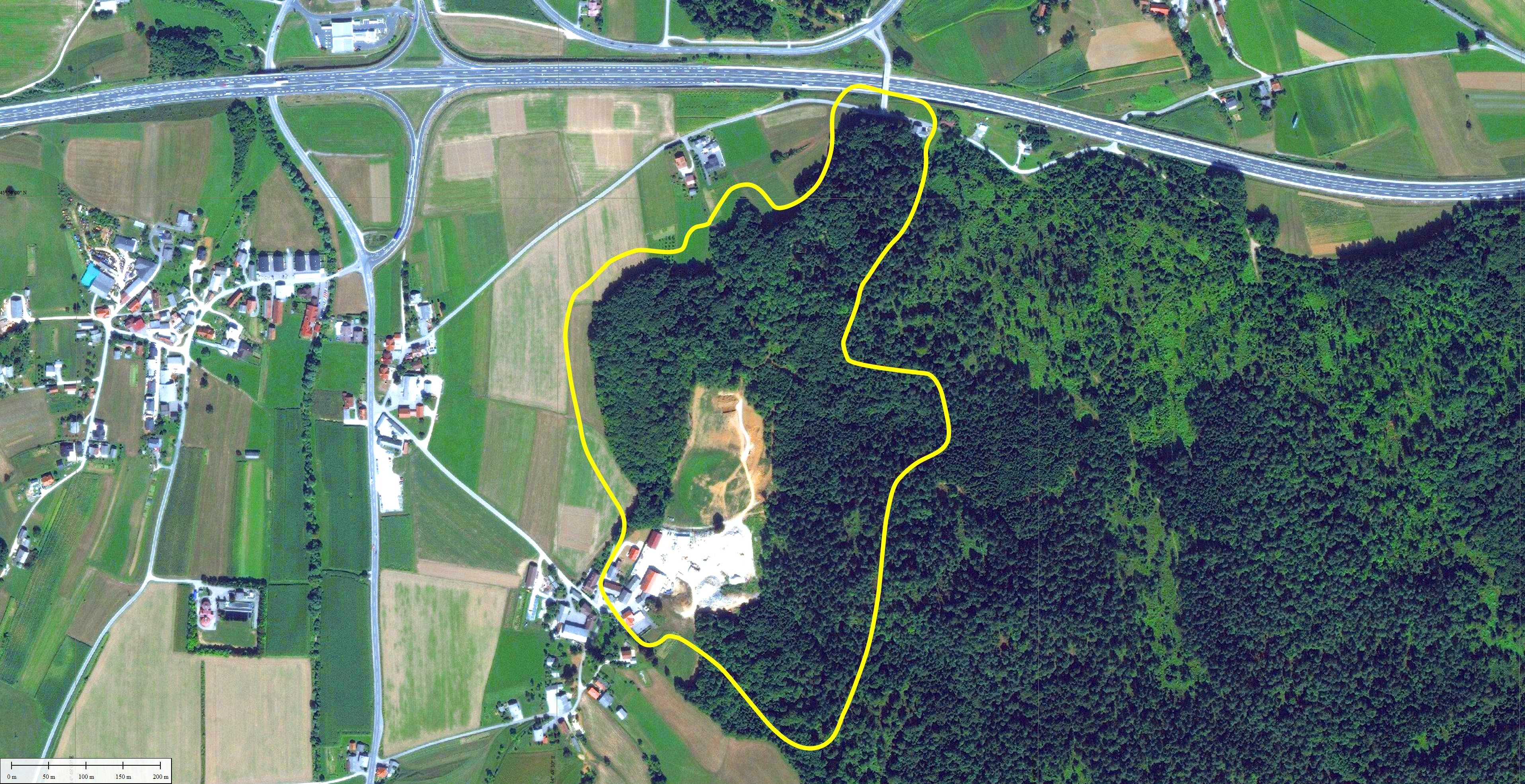
Wider area of Šentvid, Ivančna Gorica and Stična, Slovenia, was already heavily populated in the prehistoric times. By the end of the 8th century B. C., this area has grown to an important settlement called Cvinger, which was one of the major centres (castellum hegemon) of the community in Dolenjska. It was characterized by a mighty forts, burials in clan and family barrows and Situla arts. Even today the remains of the walls are clearly visible as up to 6m high embankments or terraces. Just as well preserved are some sepulchral cemeteries. Varied life in the area lasted until the arrival of the Romans. Then it moved further into the valley, but has left many traces, which during the centuries were covered with earth.
Any use of land for new industrial zones as planned by the local community might cause damage or even destruction of the historical remains. Therefore, preliminary archaeological terrain exploration and protection are necessary. The archaeologists in charge have already contacted Geavis for the analysis of the earth’s surface in the selected area.
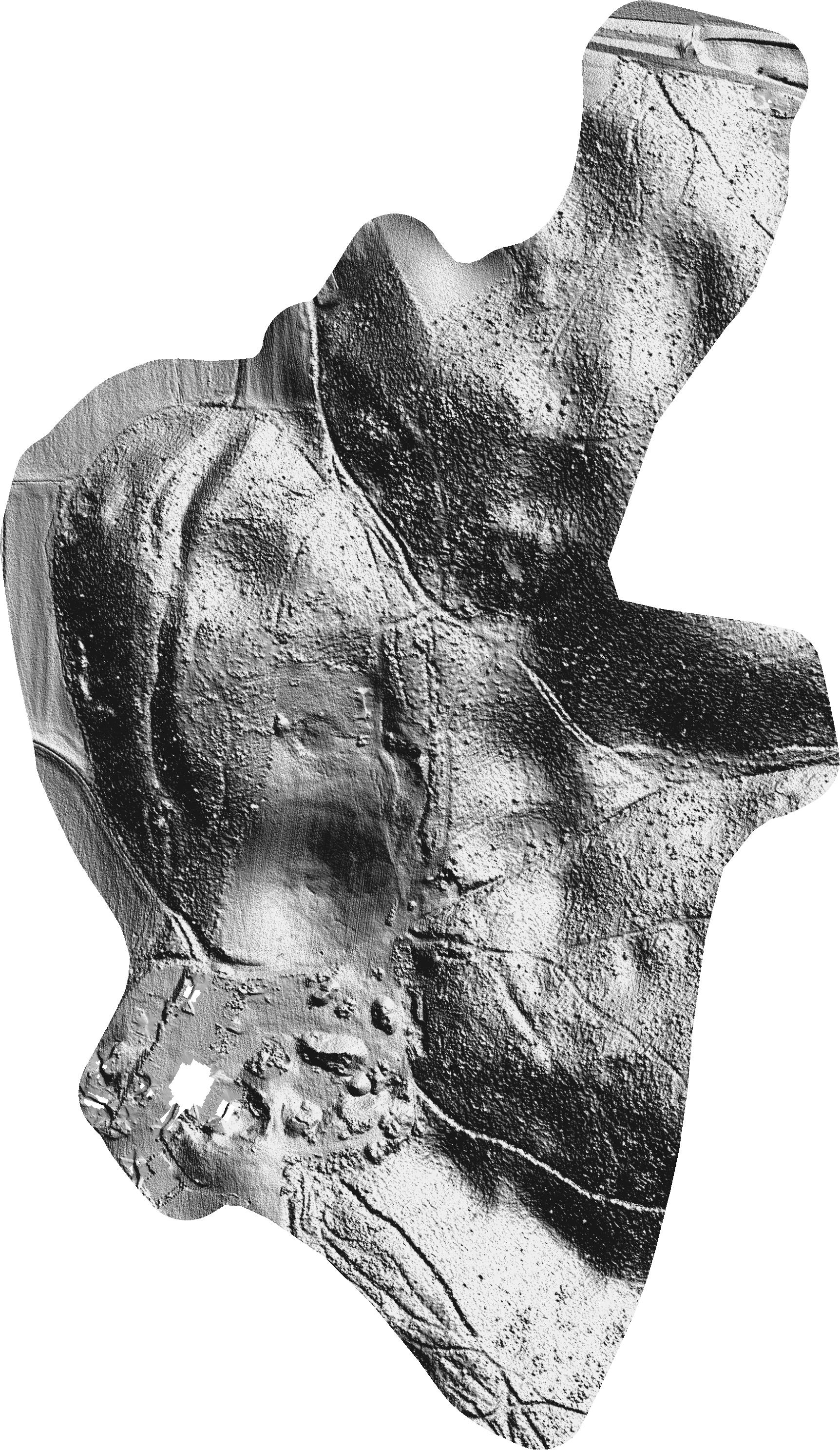
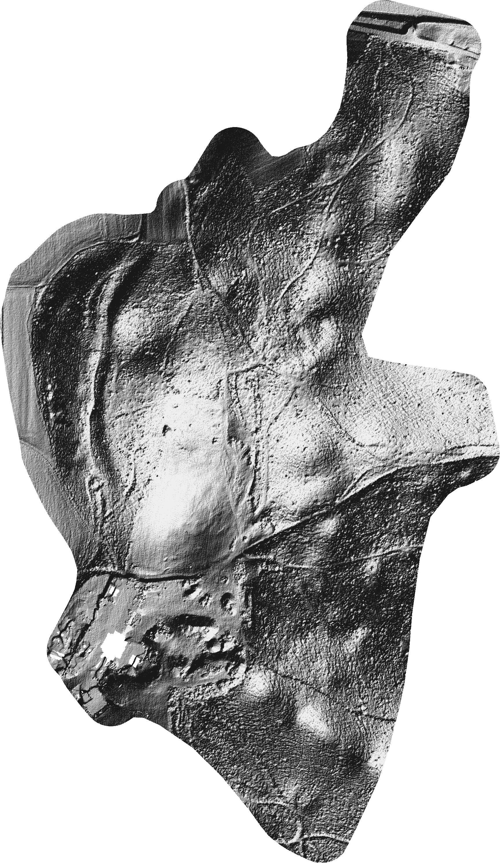
Since we speak about a largely forested area, Geavis decided to use relief data obtained by the LIDAR (standing for Light Detection And Ranging) technique of earth surface laser scanning which is the only one able to provide information on the surface covered with vegetation.
The Ministry of Environment and Spatial Planning has provided the necessary terrain data in form of a dense cloud of 3D-oriented spatial points accurately describing the observed land surface and serving as the basis for further modelling. From the already classified point cloud those ground points were picked, on which surfaces were stretched and shaded from different angles – even those not possible in nature. Geo-referenced results of analytical shading were exported in raster format with a pixel resolution of 30cm. The resulting digital models show different surface structures and variations in the landscape. The expert review and analysis reveal natural and anthropogenic geomorphological characteristics of the terrain, the latter of which might have been caused by human activities in the past. Thus discovered potential new archaeological sites are further investigated by archaeologists using conventional methods of inspection and field excavations.
Using an advanced mode of production and processing of spatial data, Geavis has achieved an effective representation of the earth’s surface. This allows the customer to easily identify potential archaeological sites – something much more difficult to achieve ba following the traditional approaches on the ground.
- Location: Ivančna Gorica surroundings
- Area size: 26 ha
- Average GSD: 30 cm
- Resolution: 30 cm/px
- Number of 3D points: 2.600.000